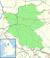
Paypay:Yorkshire Dales National Park UK location map.svg

Size of this PNG preview of this SVG file: 484 × 599 nga mga pixel. Iba nga mga resolusyon: 194 × 240 nga mga pixel | 388 × 480 nga mga pixel | 621 × 768 nga mga pixel | 828 × 1,024 nga mga pixel | 1,655 × 2,048 nga mga pixel | 1,088 × 1,346 nga mga pixel.
Orihinal nga paypay (SVG nga fayl, ginbabanabanahan nga 1,088 × 1,346 nga mga pixel, kadako han fayl: 1.18 nga MB)
Kaagi han paypay
Pidlita an adlaw/oras para makit-an an fayl nga naggawas hito nga oras.
| Pitsa/Oras | Thumbnail | Mga dimensyon | Gumaramit | Komento | |
|---|---|---|---|---|---|
| waray pa kasasapawi | 20:28, 18 Oktubre 2016 |  | 1,088 × 1,346 (1.18 nga MB) | Rcsprinter123 | 2016 amendments |
| 19:18, 30 Oktubre 2010 |  | 1,157 × 1,345 (1.14 nga MB) | Nilfanion | thicker counties + districts | |
| 21:42, 29 Oktubre 2010 |  | 1,157 × 1,345 (1.02 nga MB) | Nilfanion | {{Information |Description=Map of the Yorkshire Dales National Park, UK with the following information shown: *National Park boundary *Administrative borders *Coastline, lakes and rivers *Roads and railways *Urban areas Equirectangu |
Mga Sumpay
An mga nasunod nga mga pakli nasumpay hini nga paypay:
Global file usage
An masunod nga iba nga mga wiki in nagamit hini nga file:
- Paggamit ha ar.wikipedia.org
- Paggamit ha ceb.wikipedia.org
- Paggamit ha en.wikipedia.org
- Paggamit ha fa.wikipedia.org
- Paggamit ha he.wikipedia.org
- Paggamit ha kn.wikipedia.org
- Paggamit ha tr.wikipedia.org
- Paggamit ha vi.wikipedia.org
- Paggamit ha zh.wikipedia.org