Paypay:ValleLuna-002.jpg
Kadako hin nga pahiuna nga pagawas: 800 × 517 nga mga pixel. Iba nga mga resolusyon: 320 × 207 nga mga pixel | 640 × 414 nga mga pixel | 1,024 × 662 nga mga pixel | 1,280 × 828 nga mga pixel | 2,126 × 1,375 nga mga pixel.
Orihinal nga paypay (2,126 × 1,375 nga pixel, kadako han fayl: 3.58 nga MB, MIME nga tipo: image/jpeg)
| Tigtulidong |
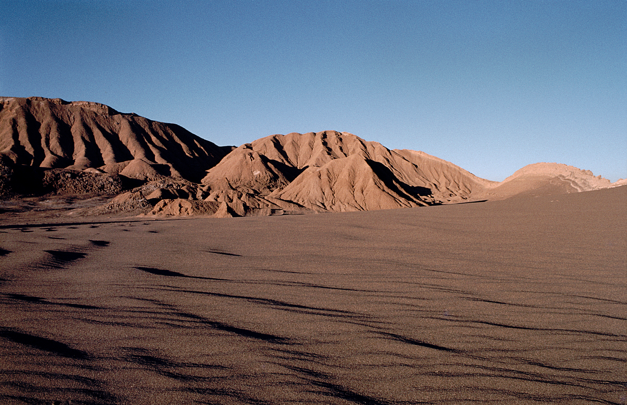
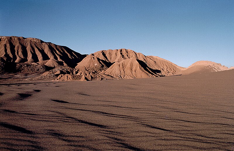
Español: En el Valle de la Luna de la Cordillera de la Sal. San Pedro de Atacama, Chile
Deutsch: Im Valle de la Luna der Cordillera de la Sal. San Pedro de Atacama, Chile |
| Petsa | |
| Ginkuhaan | Kalugaringon nga buhat |
| Awtor | Reinhard Jahn, Mannheim; nanosmile |
| Pagtugot (Gin-uutro paggamit inin nga file) |
This file is licensed under the Creative Commons Attribution-Share Alike 2.0 Germany license.
 |
The geographical information in this file was retrospectively estimated.
The location may therefore be somewhat imprecise. Verifying and refining these coordinates is strongly encouraged. |
| Camera location | | View this and other nearby images on: OpenStreetMap |
|---|
Kaagi han paypay
Pidlita an adlaw/oras para makit-an an fayl nga naggawas hito nga oras.
| Pitsa/Oras | Thumbnail | Mga dimensyon | Gumaramit | Komento | |
|---|---|---|---|---|---|
| waray pa kasasapawi | 19:07, 1 Oktubre 2005 | | 2,126 × 1,375 (3.58 nga MB) | Nanosmile | * Description = Valle de la Luna ** Source = selbst fotografiert ** Date = created March 1984 ** Author = Reinhard Jahn, Mannheim {{cc-by-sa-2.0-de}} * nanosmile * Wikipedia account * [[:de:Benutzer_Diskussi |
Mga Sumpay
An mga nasunod nga mga pakli nasumpay hini nga paypay:
Global file usage
An masunod nga iba nga mga wiki in nagamit hini nga file:
- Paggamit ha af.wikipedia.org
- Paggamit ha als.wikipedia.org
- Paggamit ha an.wikipedia.org
- Paggamit ha arc.wikipedia.org
- Paggamit ha ar.wikipedia.org
- Paggamit ha arz.wikipedia.org
- Paggamit ha azb.wikipedia.org
- Paggamit ha az.wikipedia.org
- Paggamit ha ban.wikipedia.org
- Paggamit ha bat-smg.wikipedia.org
- Paggamit ha ba.wikipedia.org
- Paggamit ha be-tarask.wikipedia.org
- Paggamit ha be.wikipedia.org
- Paggamit ha bg.wikipedia.org
- Paggamit ha br.wikipedia.org
- Paggamit ha bs.wikipedia.org
- Paggamit ha ceb.wikipedia.org
- Paggamit ha cs.wikipedia.org
- Paggamit ha cv.wikipedia.org
- Paggamit ha cy.wikipedia.org
- Paggamit ha da.wikipedia.org
- Paggamit ha da.wikibooks.org
- Paggamit ha de.wikipedia.org
- Paggamit ha el.wikipedia.org
- Paggamit ha eml.wikipedia.org
- Paggamit ha en.wikivoyage.org
- Paggamit ha eo.wikipedia.org
- Paggamit ha es.wikipedia.org
- Paggamit ha eu.wikipedia.org
- Paggamit ha fa.wikipedia.org
- Paggamit ha fa.wikibooks.org
- Paggamit ha fiu-vro.wikipedia.org
- Paggamit ha fi.wikipedia.org
- Paggamit ha fo.wikipedia.org
- Paggamit ha frr.wikipedia.org
- Paggamit ha fur.wikipedia.org
- Paggamit ha fy.wikipedia.org
- Paggamit ha ga.wikipedia.org
Kitaa durudamo nga global usage hinin nga file.