Paypay:Usa edcp relief location map.png

Kadako hin nga pahiuna nga pagawas: 800 × 495 nga mga pixel. Iba nga mga resolusyon: 320 × 198 nga mga pixel | 640 × 396 nga mga pixel | 1,181 × 731 nga mga pixel.
Orihinal nga paypay (1,181 × 731 nga pixel, kadako han fayl: 1.56 nga MB, MIME nga tipo: image/png)
Dalikyat nga pulong
| Tigtulidong |
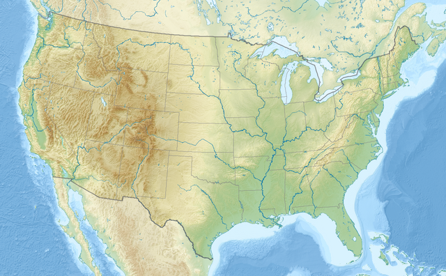
English: Relief location map of the USA (without Hawaii and Alaska).
EquiDistantConicProjection : Central parallel : * N: 37.0° N Central meridian : * E: 96.0° W Standard parallels: * 1: 32.0° N * 2: 42.0° N Made with Natural Earth. Free vector and raster map data @ naturalearthdata.com. Formulas for x and y: x = 50.0 + 124.03149777329222 * ((1.9694462586094064-({{{2}}}* pi / 180))
* sin(0.6010514667026994 * ({{{3}}} + 96) * pi / 180))
y = 50.0 + 1.6155950752393982 * 124.03149777329222 * 0.02613325650382181
- 1.6155950752393982 * 124.03149777329222 *
(1.3236744353715044 - (1.9694462586094064-({{{2}}}* pi / 180))
* cos(0.6010514667026994 * ({{{3}}} + 96) * pi / 180))
|
| Petsa | |
| Ginkuhaan | Kalugaringon nga buhat |
| Awtor | Uwe Dedering |
| Other versions |
|

Palilisensya:
I, the copyright holder of this work, hereby publish it under the following licenses:
Ini nga file in nakalisensya ha ilarom han Creative Commons Attribution-Share Alike 3.0 Unported license.
- Talwas ka:
- para han pagpasaro – para han pagkopya, pagpakalat ngan pagpadangat han buhat
- para han pagremix – pag-adapt han buhat
- Ha ilarom an masunod nga mga kondisyon:
- attribution – Kinahanglanon mo tagan hin kaangayan nga credit, paghatag hin sumpay ngadto ha lisensya, ngan igbutang an imo ginbag-ohan nga binuhat. Puydi mo ini buhaton ha bisan ano nga resonable nga pamaagi, pero diri nimo pagawson nga an naghatag hin lisensya nag-eendorso ha imo o ha imo paggamit.
- share alike – Kun imo ginsagol-hin-otro, gin-iba, o gin-hingayad han buhat, ikaw in angay gud là magpakalat han imo gin-amot ha ilarom la han [http:creativecommons.org/share-your-work/licensing-considerations/compatible-licenses pareho o naangay nga lisensya] sugad han orihinal.

|
An permiso in ginhatag ha pagkopya, pagpakalat ngan/o pagliwat hinin nga dokumento ha ilarom han mga termino han GNU Free Documentation License, Version 1.2 o mas uruurhi nga version nga ginmantala han Free Software Foundation; nga may-ada waray Invariant Sections, waray Front-Cover Texts, ngan waray Back-Cover Texts. May-ada kopya hin lisensya nga ginlalakip ha seksyon nga may-ada pamagat nga GNU Free Documentation License. |
Puydi ka pumili hin lisenysa nga karuyag mo.
Kaagi han paypay
Pidlita an adlaw/oras para makit-an an fayl nga naggawas hito nga oras.
| Pitsa/Oras | Thumbnail | Mga dimensyon | Gumaramit | Komento | |
|---|---|---|---|---|---|
| waray pa kasasapawi | 20:50, 2 Abril 2024 | | 1,181 × 731 (1.56 nga MB) | Spesh531 | correction to Rhode Island border. Little Compton and Tiverton was previously shown to be in Massachusetts |
| 16:32, 23 Disyembre 2016 |  | 1,181 × 731 (1.47 nga MB) | Jeanjung212 | Lossless Compressed/optimized png decreasing file size by 193731 bytes | |
| 10:37, 24 Agosto 2010 |  | 1,181 × 731 (1.66 nga MB) | Uwe Dedering | {{Information |Description={{en|1=Relief location map of the USA (without Hawaii and Alaska). EquiDistantConicProjection : Central parallel : * N: 37.0° N Central meridian : * E: 96.0° W Standard parallels: * 1: 32.0° N * 2: 42.0° N Made with Nat |
Mga Sumpay
An mga nasunod nga mga pakli nasumpay hini nga paypay:
Global file usage
An masunod nga iba nga mga wiki in nagamit hini nga file:
- Paggamit ha ab.wikipedia.org
- Paggamit ha ace.wikipedia.org
- Paggamit ha als.wikipedia.org
- Paggamit ha ang.wikipedia.org
- Paggamit ha ar.wikipedia.org
- قالب:خريطة مواقع
- قالب:خريطة مواقع/شرح
- قالب:خريطة مواقع الولايات المتحدة
- قالب:خريطة مواقع الولايات المتحدة2
- قالب:خريطة مواقع/ملعب
- وحدة:Location map/data/USA
- وحدة:Location map/data/United States
- وحدة:Location map/data/USA/شرح
- وحدة:Location map/data/United States of America
- كلية مونماوث
- وحدة:Location map/data/United States/شرح
- وحدة:Location map/data/United States of America/شرح
- بوينغ فيلد
- جامعات أمريكية حسب عدد الملتحقين بالمرحلة الجامعية
- جامعات الولايات المتحدة حسب عدد المسجلين
- فورتشن 1000
- تكوين هيل كريك
- انفجار صاروخ تيتان في داماسكيوس 1980
- تحطم طائرة بوينغ بي-52 في قاعدة فيرتشايلد الجوية
- Paggamit ha arz.wikipedia.org
- Paggamit ha ast.wikipedia.org
- Paggamit ha as.wikipedia.org
- Paggamit ha av.wikipedia.org
- Paggamit ha azb.wikipedia.org
Kitaa durudamo nga global usage hinin nga file.