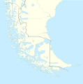
Paypay:Tierra del Fuego location map.svg

Size of this PNG preview of this SVG file: 594 × 600 nga mga pixel. Iba nga mga resolusyon: 238 × 240 nga mga pixel | 475 × 480 nga mga pixel | 761 × 768 nga mga pixel | 1,014 × 1,024 nga mga pixel | 2,028 × 2,048 nga mga pixel | 1,535 × 1,550 nga mga pixel.
Orihinal nga paypay (SVG nga fayl, ginbabanabanahan nga 1,535 × 1,550 nga mga pixel, kadako han fayl: 824 nga KB)
Kaagi han paypay
Pidlita an adlaw/oras para makit-an an fayl nga naggawas hito nga oras.
| Pitsa/Oras | Thumbnail | Mga dimensyon | Gumaramit | Komento | |
|---|---|---|---|---|---|
| waray pa kasasapawi | 16:20, 5 Marso 2024 |  | 1,535 × 1,550 (824 nga KB) | Janitoalevic | More specific Beagle Channel |
| 01:23, 29 Disyembre 2022 |  | 1,535 × 1,550 (588 nga KB) | Janitoalevic | Improved borders | |
| 19:41, 3 Mayo 2020 |  | 1,535 × 1,550 (566 nga KB) | Janitoalevic | Improved Isla de los Estados | |
| 18:47, 3 Mayo 2020 |  | 1,535 × 1,550 (558 nga KB) | Janitoalevic | Improved | |
| 23:23, 29 Agosto 2017 |  | 1,535 × 1,550 (441 nga KB) | Janitoalevic | Fixed size | |
| 11:23, 29 Agosto 2017 |  | 1,535 × 1,550 (510 nga KB) | NordNordWest | Reverted to version as of 20:59, 15 March 2016 (UTC); change of size is catastrophic to some templates | |
| 22:18, 28 Agosto 2017 |  | 1,638 × 1,653 (442 nga KB) | Janitoalevic | More precise borders and lakes | |
| 20:59, 15 Marso 2016 |  | 1,535 × 1,550 (510 nga KB) | Janitoalevic | Fixed limits following Google Earth/maps limits | |
| 22:12, 2 Marso 2016 |  | 1,535 × 1,550 (510 nga KB) | Janitoalevic | Updated | |
| 20:34, 11 Septyembre 2015 |  | 1,535 × 1,550 (508 nga KB) | Janitoalevic | Added Southern Patagonian Ice Field (Campo de hielo Patagónico Sur) undefined limits part, since 1998 For more information read: https://en.wikipedia.org/wiki/Southern_Patagonian_Ice_Field#Borderline Now with full resolution. |
Mga Sumpay
An mga nasunod nga mga pakli nasumpay hini nga paypay:
Global file usage
An masunod nga iba nga mga wiki in nagamit hini nga file:
- Paggamit ha als.wikipedia.org
- Paggamit ha ar.wikipedia.org
- Paggamit ha az.wikipedia.org
- Paggamit ha ba.wikipedia.org
- Paggamit ha bn.wikipedia.org
- Paggamit ha ceb.wikipedia.org
- Paggamit ha cs.wikipedia.org
- Paggamit ha da.wikipedia.org
- Paggamit ha de.wikipedia.org
- Paggamit ha el.wikipedia.org
- Paggamit ha en.wikipedia.org
- Tierra del Fuego
- Ushuaia – Malvinas Argentinas International Airport
- Isla Grande de Tierra del Fuego
- Puerto Williams
- Río Grande, Tierra del Fuego
- Diego Ramírez Islands
- Riesco Island
- Hoste Island
- Viedma (volcano)
- Cerro Torre
- Fitz Roy
- Viedma Lake
- Gallegos River
- Mount Darwin (Andes)
- Puerto Toro
- Dawson Island
- Ildefonso Islands
- Hermite Islands
- Southern Patagonian Ice Field
- Navarino Island
- Cordillera Darwin
- Cordillera Sarmiento
- Cueva del Milodón Natural Monument
- Londonderry Island
- Hornos Island
- Grey Lake
- Desolación Island
- Clarence Island, Chile
- Gordon Island
Kitaa durudamo nga global usage hinin nga file.


