Paypay:Spain Valencian Community location map.svg

Size of this PNG preview of this SVG file: 442 × 600 nga mga pixel. Iba nga mga resolusyon: 177 × 240 nga mga pixel | 353 × 480 nga mga pixel | 566 × 768 nga mga pixel | 754 × 1,024 nga mga pixel | 1,509 × 2,048 nga mga pixel | 512 × 695 nga mga pixel.
Orihinal nga paypay (SVG nga fayl, ginbabanabanahan nga 512 × 695 nga mga pixel, kadako han fayl: 538 nga KB)
Dalikyat nga pulong
| Tigtulidong |
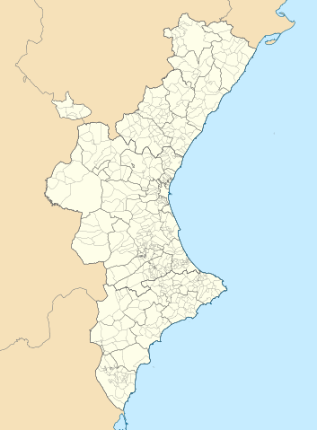
Català: Mapa de localització del País Valencià
Projecció equirrectangular, N/S estirada 130 %. Extrems geogràfics al mapa:
English: Location map of the Land of Valencia
Equirectangular projection, N/S stretching 130 %. Geographic limits of the map:
Español: Mapa de localización de la Comunidad Valenciana
Proyección equirrectangular, N/S estirada 130 %. Límites geográficos del mapa:
|
|
| Petsa | ||
| Ginkuhaan | Own work based on: EspañaLoc.svg by HansenBCN, and Own work based on: Mapa de localització a les comarques valencianes.svg by Martorell | |
| Awtor | Miguillen and Martorell | |
| SVG genesis | This locator map was created with Inkscape.
|
Palilisensya:
Miguillen, the copyright holder of this work, hereby publishes it under the following license:
Ini nga file in nakalisensya ha ilarom han Creative Commons Attribution-Share Alike 3.0 Unported license.
Attribution: Miguillen
- Talwas ka:
- para han pagpasaro – para han pagkopya, pagpakalat ngan pagpadangat han buhat
- para han pagremix – pag-adapt han buhat
- Ha ilarom an masunod nga mga kondisyon:
- attribution – Kinahanglanon mo tagan hin kaangayan nga credit, paghatag hin sumpay ngadto ha lisensya, ngan igbutang an imo ginbag-ohan nga binuhat. Puydi mo ini buhaton ha bisan ano nga resonable nga pamaagi, pero diri nimo pagawson nga an naghatag hin lisensya nag-eendorso ha imo o ha imo paggamit.
- share alike – Kun imo ginsagol-hin-otro, gin-iba, o gin-hingayad han buhat, ikaw in angay gud là magpakalat han imo gin-amot ha ilarom la han [http:creativecommons.org/share-your-work/licensing-considerations/compatible-licenses pareho o naangay nga lisensya] sugad han orihinal.
Kaagi han paypay
Pidlita an adlaw/oras para makit-an an fayl nga naggawas hito nga oras.
| Pitsa/Oras | Thumbnail | Mga dimensyon | Gumaramit | Komento | |
|---|---|---|---|---|---|
| waray pa kasasapawi | 07:29, 9 Septyembre 2022 | | 512 × 695 (538 nga KB) | Martorell | Added borders of comarques. |
| 14:39, 25 Mayo 2010 |  | 512 × 695 (494 nga KB) | Miguillen | == {{int:filedesc}} == {{Information |Description={{en|Location map of Valencian Community}} Equirectangular projection, N/S stretching 130 %. Geographic limits of the map: * N: 40.885909° N * S: 37.698098° N * W: 1.95368 |
Mga Sumpay
An mga nasunod nga mga pakli nasumpay hini nga paypay:
Global file usage
An masunod nga iba nga mga wiki in nagamit hini nga file:
- Paggamit ha ar.wikipedia.org
- Paggamit ha ast.wikipedia.org
- Paggamit ha azb.wikipedia.org
- Paggamit ha ba.wikipedia.org
- Paggamit ha bg.wikipedia.org
- Paggamit ha bn.wikipedia.org
- Paggamit ha ca.wikipedia.org
- Usuari:PereBot/cobertura/País Valencià 2/ranking
- Usuari:PereBot/cobertura/País Valencià 2/an
- Usuari:PereBot/cobertura/País Valencià 2/ca
- Usuari:PereBot/cobertura/País Valencià 2/de
- Usuari:PereBot/cobertura/País Valencià 2/en
- Usuari:PereBot/cobertura/País Valencià 2/es
- Usuari:PereBot/cobertura/País Valencià 2/eu
- Usuari:PereBot/cobertura/País Valencià 2/fr
- Usuari:PereBot/cobertura/País Valencià 2/nl
Kitaa durudamo nga global usage hinin nga file.