Paypay:Saint-Martin collectivity location map.svg

Size of this PNG preview of this SVG file: 800 × 578 nga mga pixel. Iba nga mga resolusyon: 320 × 231 nga mga pixel | 640 × 462 nga mga pixel | 1,024 × 740 nga mga pixel | 1,280 × 925 nga mga pixel | 2,560 × 1,850 nga mga pixel | 1,175 × 849 nga mga pixel.
Orihinal nga paypay (SVG nga fayl, ginbabanabanahan nga 1,175 × 849 nga mga pixel, kadako han fayl: 182 nga KB)
Dalikyat nga pulong
| Camera location | | View this and other nearby images on: OpenStreetMap |
|---|
| Tigtulidong |
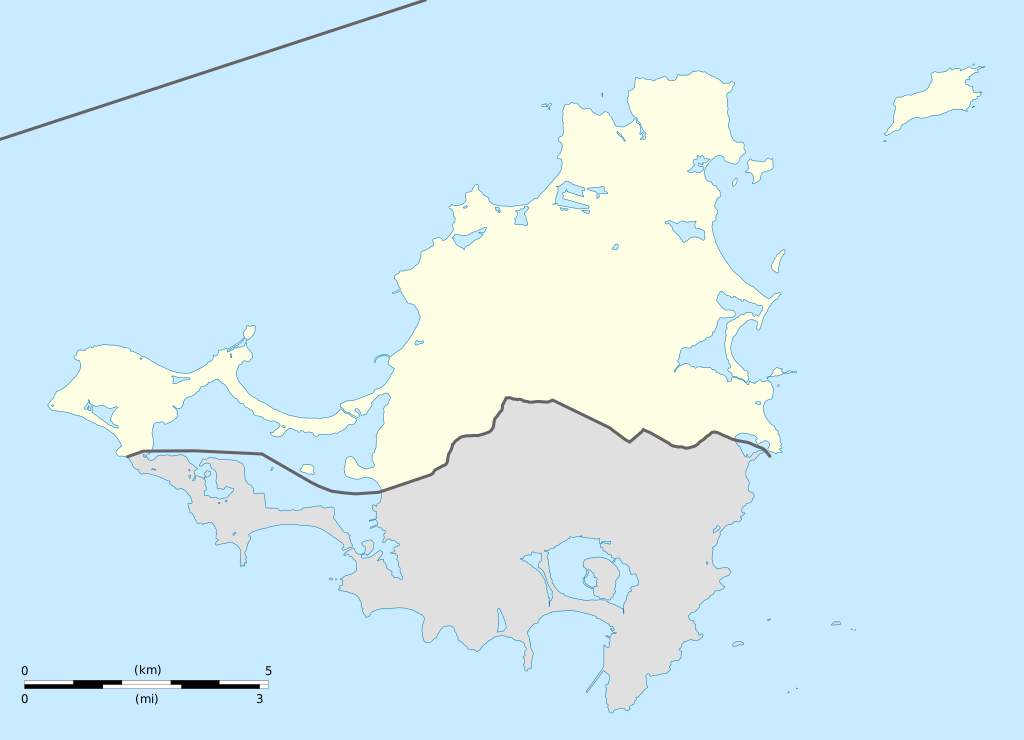
English: Blank administrative map of the overseas collectivity of Saint Martin, France, for geo-location purpose.
Français : Carte administrative vierge de la collectivité d'outre-mer de Saint-Martin, France, destinée à la géolocalisation. Estimated scale: 1:200,000 (precision: 50 m)
Geographic limits of the map:
|
||
| Petsa | |||
| Ginkuhaan |
Kalugaringon nga buhat
|
||
| Awtor | Eric Gaba (Sting - fr:Sting) | ||
| Pagtugot (Gin-uutro paggamit inin nga file) |
|
||
| Other versions |
|


Palilisensya:
I, the copyright holder of this work, hereby publish it under the following licenses:
Ini nga file in nakalisensya ha ilarom han Creative Commons Attribution-Share Alike 3.0 Unported license.
- Talwas ka:
- para han pagpasaro – para han pagkopya, pagpakalat ngan pagpadangat han buhat
- para han pagremix – pag-adapt han buhat
- Ha ilarom an masunod nga mga kondisyon:
- attribution – Kinahanglanon mo tagan hin kaangayan nga credit, paghatag hin sumpay ngadto ha lisensya, ngan igbutang an imo ginbag-ohan nga binuhat. Puydi mo ini buhaton ha bisan ano nga resonable nga pamaagi, pero diri nimo pagawson nga an naghatag hin lisensya nag-eendorso ha imo o ha imo paggamit.
- share alike – Kun imo ginsagol-hin-otro, gin-iba, o gin-hingayad han buhat, ikaw in angay gud là magpakalat han imo gin-amot ha ilarom la han [http:creativecommons.org/share-your-work/licensing-considerations/compatible-licenses pareho o naangay nga lisensya] sugad han orihinal.

|
An permiso in ginhatag ha pagkopya, pagpakalat ngan/o pagliwat hinin nga dokumento ha ilarom han mga termino han GNU Free Documentation License, Version 1.2 o mas uruurhi nga version nga ginmantala han Free Software Foundation; nga may-ada waray Invariant Sections, waray Front-Cover Texts, ngan waray Back-Cover Texts. May-ada kopya hin lisensya nga ginlalakip ha seksyon nga may-ada pamagat nga GNU Free Documentation License. |
Puydi ka pumili hin lisenysa nga karuyag mo.
Kaagi han paypay
Pidlita an adlaw/oras para makit-an an fayl nga naggawas hito nga oras.
| Pitsa/Oras | Thumbnail | Mga dimensyon | Gumaramit | Komento | |
|---|---|---|---|---|---|
| waray pa kasasapawi | 19:42, 17 Enero 2009 | | 1,175 × 849 (182 nga KB) | Sting | == Summary == {{Location|18|04|07|N|63|03|45|W|scale:100000}} <br/> {{Information |Description={{en|Blank administrative map of the overseas collectivity of Saint Martin, France, f |
Mga Sumpay
An mga nasunod nga mga pakli nasumpay hini nga paypay:
Global file usage
An masunod nga iba nga mga wiki in nagamit hini nga file:
- Paggamit ha af.wikipedia.org
- Paggamit ha als.wikipedia.org
- Paggamit ha an.wikipedia.org
- Paggamit ha ar.wikipedia.org
- Paggamit ha ast.wikipedia.org
- Paggamit ha be-tarask.wikipedia.org
- Paggamit ha bg.wikipedia.org
- Paggamit ha bn.wikipedia.org
- Paggamit ha bs.wikipedia.org
- Paggamit ha ceb.wikipedia.org
- Plantilya:Location map Saint-Martin
- Green Cay
- Eastern Point
- Red Hill
- Bell Point
- Flagstaff
- Saint-Martin (pagklaro)
- Île Frégate
- Red Rock
- Hope Hill
- Bell Hill
- Pointe Noire
- Marigot
- Le Paradis
- Baie Rouge
- Crocus Hill
- Île Charlotte
- Lac Simpson
- Lac Simson
- Montagne Ronde
- Pointe Bluff
- Pointe Nord
- Saint Martin (pagklaro)
- La Selle
- Mont Fortune
- Baie du Marigot
- Grand Îlet
- Morne Rond
- Le Selle
- Simson Baai Lagoen
- Sint Maarten (pagklaro)
- Pointe Falaise
- Pointe du Bluff
- Spaniard Rock
- Baie Blanche
- Concordia Hill
- Mont des Accords
Kitaa durudamo nga global usage hinin nga file.