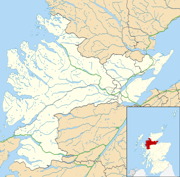
Paypay:Ross and Cromarty UK location map.svg

Size of this PNG preview of this SVG file: 610 × 599 nga mga pixel. Iba nga mga resolusyon: 244 × 240 nga mga pixel | 489 × 480 nga mga pixel | 782 × 768 nga mga pixel | 1,042 × 1,024 nga mga pixel | 2,085 × 2,048 nga mga pixel | 1,425 × 1,400 nga mga pixel.
Orihinal nga paypay (SVG nga fayl, ginbabanabanahan nga 1,425 × 1,400 nga mga pixel, kadako han fayl: 3.04 nga MB)
Kaagi han paypay
Pidlita an adlaw/oras para makit-an an fayl nga naggawas hito nga oras.
| Pitsa/Oras | Thumbnail | Mga dimensyon | Gumaramit | Komento | |
|---|---|---|---|---|---|
| waray pa kasasapawi | 23:31, 4 Marso 2011 |  | 1,425 × 1,400 (3.04 nga MB) | Nilfanion | {{Information |Description=Map of Ross and Cromarty, UK in 2011, with the following information shown: *Ward boundaries *Coastline and lakes *Roads and railways *Urban areas Equirectangular map projection on WGS 84 datum, with N/S |
Mga Sumpay
An mga nasunod nga mga pakli nasumpay hini nga paypay:
Global file usage
An masunod nga iba nga mga wiki in nagamit hini nga file:
- Paggamit ha ar.wikipedia.org
- Paggamit ha be.wikipedia.org
- Paggamit ha br.wikipedia.org
- Paggamit ha ceb.wikipedia.org
- Paggamit ha en.wikipedia.org
- Achduart
- Achiltibuie
- Cromarty
- Gairloch
- Ullapool
- Dingwall
- Fortrose
- Kyle of Lochalsh
- Lochcarron
- Culbokie
- Portmahomack
- Hill of Fearn
- Strathpeffer
- Loch Kishorn
- Glenelg, Highland
- Saltburn, Ross and Cromarty
- Dornie
- Invergordon
- Applecross
- Hilton of Cadboll
- Achanalt
- Achandunie
- Alness
- Rosemarkie
- Achintraid
- Ardarroch
- Evanton
- Kildary
- Jemimaville
- Shieldaig
- Kinlochewe
- Poolewe
- Scoraig
- Victoria Park, Dingwall
- Coigach
- Conon Bridge
- North Kessock
- Munlochy
- Edderton
- Duirinish, Lochalsh
- Garve
- Muir of Ord
- Corran, Loch Hourn
- Milton, Easter Ross
- HMS Fieldfare
- Maryburgh
Kitaa durudamo nga global usage hinin nga file.