Paypay:Relief Map of Czech Republic.png

Kadako hin nga pahiuna nga pagawas: 800 × 486 nga mga pixel. Iba nga mga resolusyon: 320 × 195 nga mga pixel | 640 × 389 nga mga pixel | 1,000 × 608 nga mga pixel.
Orihinal nga paypay (1,000 × 608 nga pixel, kadako han fayl: 866 nga KB, MIME nga tipo: image/png)
Dalikyat nga pulong
| Tigtulidong |
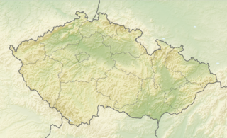
English: Relief map of the Czech Republic
Equirectangular projection, N/S stretching 150 %. Geographic limits of the map:
|
| Petsa | |
| Ginkuhaan |
|
| Awtor | derivative work Виктор_В |
Palilisensya:
Ini nga file in nakalisensya ha ilarom han Creative Commons Attribution-Share Alike 3.0 Unported license.
- Talwas ka:
- para han pagpasaro – para han pagkopya, pagpakalat ngan pagpadangat han buhat
- para han pagremix – pag-adapt han buhat
- Ha ilarom an masunod nga mga kondisyon:
- attribution – Kinahanglanon mo tagan hin kaangayan nga credit, paghatag hin sumpay ngadto ha lisensya, ngan igbutang an imo ginbag-ohan nga binuhat. Puydi mo ini buhaton ha bisan ano nga resonable nga pamaagi, pero diri nimo pagawson nga an naghatag hin lisensya nag-eendorso ha imo o ha imo paggamit.
- share alike – Kun imo ginsagol-hin-otro, gin-iba, o gin-hingayad han buhat, ikaw in angay gud là magpakalat han imo gin-amot ha ilarom la han [http:creativecommons.org/share-your-work/licensing-considerations/compatible-licenses pareho o naangay nga lisensya] sugad han orihinal.
Kaagi han paypay
Pidlita an adlaw/oras para makit-an an fayl nga naggawas hito nga oras.
| Pitsa/Oras | Thumbnail | Mga dimensyon | Gumaramit | Komento | |
|---|---|---|---|---|---|
| waray pa kasasapawi | 08:37, 11 Enero 2021 | | 1,000 × 608 (866 nga KB) | ThecentreCZ | Reverted to version as of 11:53, 28 August 2010 (UTC) V Ústavním pořádku České republiky nemají zemské hranice žádné ukotvení a jsou jen přežitkem |
| 22:48, 10 Enero 2021 |  | 1,000 × 608 (780 nga KB) | Osidor | přidány zemské hranice (důvod: na mapě jsou užitečné nejméně stejně jako ty krajské [spíše však více]) | |
| 11:53, 28 Agosto 2010 |  | 1,000 × 608 (866 nga KB) | Виктор В | == {{int:filedesc}} == {{Information |Description={{en|Location map of the Czech Republic}} Equirectangular projection, N/S stretching 150 %. Geographic limits of the map: * N: 51.3° N * S: 48.3° N * W: 11.8° E * O: 19.2° |
Mga Sumpay
An mga nasunod nga mga pakli nasumpay hini nga paypay:
Global file usage
An masunod nga iba nga mga wiki in nagamit hini nga file:
- Paggamit ha als.wikipedia.org
- Paggamit ha arz.wikipedia.org
- Paggamit ha ast.wikipedia.org
- Paggamit ha azb.wikipedia.org
- Paggamit ha az.wikipedia.org
- Paggamit ha ba.wikipedia.org
- Paggamit ha be-tarask.wikipedia.org
- Paggamit ha be.wikipedia.org
- Paggamit ha bg.wikipedia.org
Kitaa durudamo nga global usage hinin nga file.