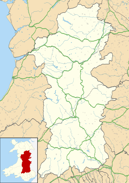
Paypay:Powys UK location map.svg

Size of this PNG preview of this SVG file: 424 × 599 nga mga pixel. Iba nga mga resolusyon: 170 × 240 nga mga pixel | 340 × 480 nga mga pixel | 544 × 768 nga mga pixel | 725 × 1,024 nga mga pixel | 1,450 × 2,048 nga mga pixel | 924 × 1,305 nga mga pixel.
Orihinal nga paypay (SVG nga fayl, ginbabanabanahan nga 924 × 1,305 nga mga pixel, kadako han fayl: 1.75 nga MB)
Kaagi han paypay
Pidlita an adlaw/oras para makit-an an fayl nga naggawas hito nga oras.
| Pitsa/Oras | Thumbnail | Mga dimensyon | Gumaramit | Komento | |
|---|---|---|---|---|---|
| waray pa kasasapawi | 19:41, 26 Septyembre 2010 |  | 924 × 1,305 (1.75 nga MB) | Nilfanion | {{Information |Description=Blank map of Powys, UK with the following information shown: *Administrative borders *Coastline, lakes and rivers *Roads and railways *Urban areas Equirectangular map projection on WGS 84 datum, with N/S stretched |
Mga Sumpay
An mga nasunod nga mga pakli nasumpay hini nga paypay:
Global file usage
An masunod nga iba nga mga wiki in nagamit hini nga file:
- Paggamit ha ar.wikipedia.org
- Paggamit ha azb.wikipedia.org
- Paggamit ha ca.wikipedia.org
- Paggamit ha ceb.wikipedia.org
- Paggamit ha cy.wikipedia.org
- Paggamit ha da.wikipedia.org
- Paggamit ha en.wikipedia.org
- Hay-on-Wye
- Llansantffraed
- List of monastic houses in Wales
- Powys
- Brecon
- Welshpool
- Machynlleth
- Llan, Powys
- Newtown, Powys
- Llanrhaeadr-ym-Mochnant
- Llanidloes
- Knighton, Powys
- New Radnor
- Presteigne
- Rhayader
- Builth Wells
- Llanwrtyd Wells
- Llandrindod Wells
- Llanwrtyd
- Montgomery, Powys
- Crickhowell
- Talgarth
- Ystradfellte
- Ystradgynlais
- Llandrinio
- Caersws
- Pontdolgoch
- Llanfair Caereinion
- Llanymynech
- Criggion Radio Station
- Llanelwedd
- Meifod
- Bwlch
- Pontneddfechan
- Trecastle
- Bettws Cedewain
- Beulah, Powys
- Talybont-on-Usk
- Bronllys
- Llandinam
- Abermule
- Van, Llanidloes
- Berriew
Kitaa durudamo nga global usage hinin nga file.