Paypay:Ph locator region 7.png
Waray mas hiruhitaas nga resolusyon.
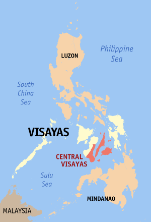
Ph_locator_region_7.png (300 × 440 nga pixel, kadako han fayl: 17 nga KB, MIME nga tipo: image/png)
Map of the Philippines showing the location of Central Visayas.
Created and copyright (2003) by seav. Released under the GFDL.
Source: English Wikipedia
seav from en.wikipedia.org, the copyright holder of this work, hereby publishes it under the following license:

|
An permiso in ginhatag ha pagkopya, pagpakalat ngan/o pagliwat hinin nga dokumento ha ilarom han mga termino han GNU Free Documentation License, Version 1.2 o mas uruurhi nga version nga ginmantala han Free Software Foundation; nga may-ada waray Invariant Sections, waray Front-Cover Texts, ngan waray Back-Cover Texts. May-ada kopya hin lisensya nga ginlalakip ha seksyon nga may-ada pamagat nga GNU Free Documentation License. |
| Ini nga file in nakalisensya ha ilarom han Creative Commons Attribution-Share Alike 3.0 Unported license. | ||
| Attribution: seav | ||
| ||
| This licensing tag was added to this file as part of the GFDL licensing update. |
Kaagi han paypay
Pidlita an adlaw/oras para makit-an an fayl nga naggawas hito nga oras.
| Pitsa/Oras | Thumbnail | Mga dimensyon | Gumaramit | Komento | |
|---|---|---|---|---|---|
| waray pa kasasapawi | 02:31, 15 Agosto 2017 | | 300 × 440 (17 nga KB) | Nikbert16 | Reverted to version as of 23:38, 27 February 2006 (UTC) Negros Island Region abolish. Reverting Negros Oriental back into Central Visayas. |
| 05:31, 6 Hunyo 2015 |  | 300 × 440 (31 nga KB) | Hariboneagle927 | Negros Island Region created | |
| 23:38, 27 Pebrero 2006 |  | 300 × 440 (17 nga KB) | Magalhães | ||
| 20:03, 14 Septyembre 2005 |  | 300 × 450 (11 nga KB) | Magalhães | Map of the Philippines showing the location of Central Visayas. Created and copyright (2003) by seav. Released under the GNU FDL. Source: [http://en.wikipedia.org/wiki/Image:Ph_locator_region_7.png English Wikipedia] {{GFDL}} [[Category:Maps of the Phi |
Mga Sumpay
An mga nasunod nga mga pakli nasumpay hini nga paypay:
Global file usage
An masunod nga iba nga mga wiki in nagamit hini nga file:
- Paggamit ha ceb.wikipedia.org
- Paggamit ha da.wikipedia.org
- Paggamit ha en.wikipedia.org
- Paggamit ha fi.wikipedia.org
- Paggamit ha he.wikipedia.org
- Paggamit ha hi.wikipedia.org
- Paggamit ha hr.wikipedia.org
- Paggamit ha id.wikipedia.org
- Paggamit ha ilo.wikipedia.org
- Paggamit ha incubator.wikimedia.org
- Paggamit ha it.wikipedia.org
- Paggamit ha it.wikivoyage.org
- Paggamit ha ja.wikipedia.org
- Paggamit ha ko.wikipedia.org
- Paggamit ha la.wikipedia.org
- Paggamit ha lt.wikipedia.org
- Paggamit ha mk.wikipedia.org
- Paggamit ha pam.wikipedia.org
- Paggamit ha pl.wikipedia.org
- Paggamit ha pt.wikipedia.org
- Paggamit ha ru.wikipedia.org
- Paggamit ha sco.wikipedia.org
- Paggamit ha sv.wikipedia.org
- Paggamit ha ta.wikipedia.org
- Paggamit ha th.wikipedia.org
- Paggamit ha tr.wikipedia.org
- Paggamit ha uk.wikipedia.org
- Paggamit ha ur.wikipedia.org
- Paggamit ha vec.wikipedia.org
- Paggamit ha vi.wikipedia.org
- Paggamit ha zh-yue.wikipedia.org
- Paggamit ha zh.wikipedia.org