Paypay:Map indicating Hudson Strait, Nunavut, Canada.png
Map_indicating_Hudson_Strait,_Nunavut,_Canada.png (410 × 370 nga pixel, kadako han fayl: 52 nga KB, MIME nga tipo: image/png)
Dalikyat nga pulong
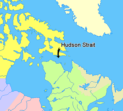
Map indicating Hudson Strait, Nunavut, Canada.
© Her Majesty the Queen in Right of Canada, Department of Natural Resources. All rights reserved.
Licence Agreement
Palilisensya:

|
The copyright holder of this work allows anyone to use it for any purpose including unrestricted redistribution, commercial use, and modification.
Usage notes:
|
Kaagi han paypay
Pidlita an adlaw/oras para makit-an an fayl nga naggawas hito nga oras.
| Pitsa/Oras | Thumbnail | Mga dimensyon | Gumaramit | Komento | |
|---|---|---|---|---|---|
| waray pa kasasapawi | 13:55, 21 Marso 2006 | | 410 × 370 (52 nga KB) | David Kernow~commonswiki | == Summary == Map indicating Hudson Strait, Nunavut, Canada. {{legend|#ffff66|Nunavut}} {{legend|#ffffcc|Greenland}} {{legend|#d5fe94|Quebec}} {{legend|#ecebb6|Newfoundland and Labrador}} {{legend|#ccccff|Manitoba}} {{legend|#ffcccc|O |
Mga Sumpay
An mga nasunod nga mga pakli nasumpay hini nga paypay:
Global file usage
An masunod nga iba nga mga wiki in nagamit hini nga file:
- Paggamit ha ar.wikipedia.org
- Paggamit ha az.wikipedia.org
- Paggamit ha ba.wikipedia.org
- Paggamit ha bg.wikipedia.org
- Paggamit ha bn.wikipedia.org
- Paggamit ha ca.wikipedia.org
- Paggamit ha cs.wikipedia.org
- Paggamit ha da.wikipedia.org
- Paggamit ha de.wikipedia.org
- Paggamit ha en.wikipedia.org
- Paggamit ha eo.wikipedia.org
- Paggamit ha eu.wikipedia.org
- Paggamit ha fa.wikipedia.org
- Paggamit ha fi.wikipedia.org
- Paggamit ha fr.wikipedia.org
- Paggamit ha gl.wikipedia.org
- Paggamit ha he.wikipedia.org
- Paggamit ha hr.wikipedia.org
- Paggamit ha id.wikipedia.org
- Paggamit ha it.wikipedia.org
- Paggamit ha ka.wikipedia.org
- Paggamit ha la.wikipedia.org
- Paggamit ha li.wikipedia.org
- Paggamit ha lt.wikipedia.org
- Paggamit ha mhr.wikipedia.org
- Paggamit ha ml.wikipedia.org
- Paggamit ha nl.wikipedia.org
- Paggamit ha nn.wikipedia.org
- Paggamit ha no.wikipedia.org
- Paggamit ha pl.wikipedia.org
- Paggamit ha pt.wikipedia.org
- Paggamit ha ru.wikipedia.org
- Paggamit ha simple.wikipedia.org
- Paggamit ha sk.wikipedia.org
- Paggamit ha sl.wikipedia.org
- Paggamit ha sr.wikipedia.org
- Paggamit ha sv.wikipedia.org
- Paggamit ha sw.wikipedia.org
- Paggamit ha uz.wikipedia.org
- Paggamit ha vi.wikipedia.org