Paypay:Map indicating Amundsen Gulf, Northwest Territories, Canada.png
Map_indicating_Amundsen_Gulf,_Northwest_Territories,_Canada.png (395 × 370 nga pixel, kadako han fayl: 60 nga KB, MIME nga tipo: image/png)
Dalikyat nga pulong
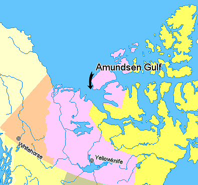
Map indicating Amundsen Gulf, Northwest Territories, Canada.
© Her Majesty the Queen in Right of Canada, Department of Natural Resources. All rights reserved.
Licence Agreement
Palilisensya:

|
The copyright holder of this work allows anyone to use it for any purpose including unrestricted redistribution, commercial use, and modification.
Usage notes:
|
Kaagi han paypay
Pidlita an adlaw/oras para makit-an an fayl nga naggawas hito nga oras.
| Pitsa/Oras | Thumbnail | Mga dimensyon | Gumaramit | Komento | |
|---|---|---|---|---|---|
| waray pa kasasapawi | 01:42, 21 Marso 2006 | | 395 × 370 (60 nga KB) | David Kernow~commonswiki | Map indicating Amundsen Gulf, Northwest Territories, Canada. {{legend|#ffff66|Nunavut}} {{legend|#ffccff|Northwest Territories}} {{legend|#ffcc99|Yukon Territory}} {{legend|#ffff99|British Columbia}} {{legend|#ffffcc|Alaska}} <br> © |
Mga Sumpay
An mga nasunod nga mga pakli nasumpay hini nga paypay:
Global file usage
An masunod nga iba nga mga wiki in nagamit hini nga file:
- Paggamit ha af.wikipedia.org
- Paggamit ha az.wikipedia.org
- Paggamit ha bg.wikipedia.org
- Paggamit ha bn.wikipedia.org
- Paggamit ha bs.wikipedia.org
- Paggamit ha cs.wikipedia.org
- Paggamit ha de.wikipedia.org
- Paggamit ha en.wikipedia.org
- Paggamit ha eo.wikipedia.org
- Paggamit ha es.wikipedia.org
- Paggamit ha et.wikipedia.org
- Paggamit ha eu.wikipedia.org
- Paggamit ha fa.wikipedia.org
- Paggamit ha fr.wikipedia.org
- Paggamit ha fy.wikipedia.org
- Paggamit ha hi.wikipedia.org
- Paggamit ha ilo.wikipedia.org
- Paggamit ha it.wikipedia.org
- Paggamit ha ja.wikipedia.org
- Paggamit ha ka.wikipedia.org
- Paggamit ha ko.wikipedia.org
- Paggamit ha ku.wikipedia.org
- Paggamit ha la.wikipedia.org
- Paggamit ha lt.wikipedia.org
- Paggamit ha mk.wikipedia.org
- Paggamit ha nl.wikipedia.org
- Paggamit ha nn.wikipedia.org
- Paggamit ha pa.wikipedia.org
- Paggamit ha pl.wikipedia.org
- Paggamit ha pl.wiktionary.org
- Paggamit ha pnb.wikipedia.org
- Paggamit ha sh.wikipedia.org
- Paggamit ha sl.wikipedia.org
- Paggamit ha sr.wikipedia.org
- Paggamit ha tr.wikipedia.org
- Paggamit ha uk.wikipedia.org
- Paggamit ha ur.wikipedia.org
- Paggamit ha vi.wikipedia.org
- Paggamit ha xmf.wikipedia.org
- Paggamit ha zh-min-nan.wikipedia.org
- Paggamit ha zh.wikipedia.org