Paypay:Map highlighting Cass Township, Sullivan County, Indiana.svg

Size of this PNG preview of this SVG file: 512 × 512 nga mga pixel. Iba nga mga resolusyon: 240 × 240 nga mga pixel | 480 × 480 nga mga pixel | 768 × 768 nga mga pixel | 1,024 × 1,024 nga mga pixel | 2,048 × 2,048 nga mga pixel.
Orihinal nga paypay (SVG nga fayl, ginbabanabanahan nga 512 × 512 nga mga pixel, kadako han fayl: 26 nga KB)
Dalikyat nga pulong
| Tigtulidong |
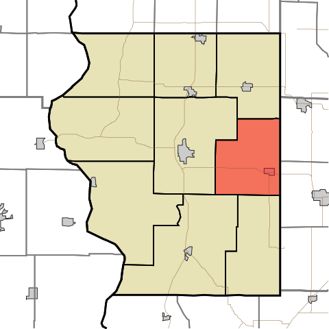
English: This is a map of Sullivan County, Indiana, USA which highlights the location of Cass Township. |
| Petsa | |
| Ginkuhaan | My own work, using freely-available TIGER data and custom-written MapScript applications |
| Awtor | Omnedon |
| Other versions | Derivative works of this file: Map of Sullivan County Indiana Townships.svg |
Palilisensya:
| I, the copyright holder of this work, release this work into the public domain. This applies worldwide. In some countries this may not be legally possible; if so: I grant anyone the right to use this work for any purpose, without any conditions, unless such conditions are required by law. |
Kaagi han paypay
Pidlita an adlaw/oras para makit-an an fayl nga naggawas hito nga oras.
| Pitsa/Oras | Thumbnail | Mga dimensyon | Gumaramit | Komento | |
|---|---|---|---|---|---|
| waray pa kasasapawi | 20:01, 24 Nobyembre 2007 | | 512 × 512 (26 nga KB) | File Upload Bot (Omnedon) | == Summary == {{Information |Description={{en|This is a map of Sullivan County, Indiana, USA which highlights the location of Cass Township.}} |Source=My own work, using freely-available TIGER data and custom-written MapScript applications |Date=2007-11- |
Mga Sumpay
Waray pakli nga nagamit hinin nga file.
Global file usage
An masunod nga iba nga mga wiki in nagamit hini nga file:
- Paggamit ha en.wikipedia.org
- Paggamit ha eu.wikipedia.org
- Paggamit ha ur.wikipedia.org
- Paggamit ha vi.wikipedia.org
- Paggamit ha www.wikidata.org
- Paggamit ha zh.wikipedia.org