Paypay:London Thames Sunset panorama - Feb 2008.jpg

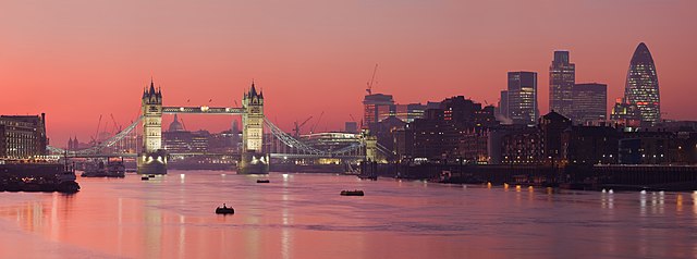
Kadako hin nga pahiuna nga pagawas: 800 × 297 nga mga pixel. Iba nga mga resolusyon: 320 × 119 nga mga pixel | 640 × 238 nga mga pixel | 1,024 × 380 nga mga pixel | 1,280 × 475 nga mga pixel | 2,560 × 951 nga mga pixel | 13,126 × 4,876 nga mga pixel.
Orihinal nga paypay (13,126 × 4,876 nga pixel, kadako han fayl: 17.7 nga MB, MIME nga tipo: image/jpeg)
Dalikyat nga pulong
| Tigtulidong |
العربية: صُورة پانوراميَّة من عدَّة مقاطع لأُفق لندن من على ضفَّة برموندساي لنهر التيمز.
Čeština: Podvečerní panorama Londýna
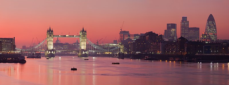
English: A multi segment panoramic image of the London skyline from the Bermondsey banks of the Thames, in which the Tower Bridge and 30 St Mary Axe are visible.
|
| Petsa | Pebrero 2008 (18 Pebrero 2008, according to Exif data) |
| Ginkuhaan | Kalugaringon nga buhat |
| Awtor | Diliff |
| Pagtugot (Gin-uutro paggamit inin nga file) |
Summary:In using this image or any subsequent derivatives of it, you are required to release the image under the same license. As such, any reproduction of this image, in any medium, must appear with a copy of, or full URL of the license.Attribution of this image to the author (DAVID ILIFF) is also required, preferably in a prominent location near the image.No other conditions may be added to, or removed from this license without the permission of the author and copyright holder.Suggested attribution: "Photo by DAVID ILIFF. License: CC BY-SA 3.0"Please review the full license requirements carefully before using this image. If you would like to clarify the terms of the license or negotiate less restrictive commercial licensing outside of the bounds of GFDL/CC-BY-SA, please contact me by email, or if you don't have a Wikipedia account you can either leave a message on my talk page with your contact details and your request, or you can contact me on Facebook. Please also send a 'friend request' to ensure that I am aware of your message. |
| Other versions |
Derivative works of this file: |
| Camera location | | View this and other nearby images on: OpenStreetMap |
|---|
|

.jpg)
This image was selected as picture of the day on Wikimedia Commons for 27 July 2012. It was captioned as follows: Other languages:
Русский: Панорама Лондона, столицы Олимпийских игр 2012 года മലയാളം : ലണ്ടൻ, 2012 ഒളിമ്പിക്സിന്റെ ആതിഥേയ പട്ടണം. |
Palilisensya:
I, the copyright holder of this work, hereby publish it under the following licenses:

|
An permiso in ginhatag ha pagkopya, pagpakalat ngan/o pagliwat hinin nga dokumento ha ilarom han mga termino han GNU Free Documentation License, Version 1.2 o mas uruurhi nga version nga ginmantala han Free Software Foundation; nga may-ada waray Invariant Sections, waray Front-Cover Texts, ngan waray Back-Cover Texts. May-ada kopya hin lisensya nga ginlalakip ha seksyon nga may-ada pamagat nga GNU Free Documentation License. |
This file is licensed under the Creative Commons Attribution 3.0 Unported license.
- Talwas ka:
- para han pagpasaro – para han pagkopya, pagpakalat ngan pagpadangat han buhat
- para han pagremix – pag-adapt han buhat
- Ha ilarom an masunod nga mga kondisyon:
- attribution – Kinahanglanon mo tagan hin kaangayan nga credit, paghatag hin sumpay ngadto ha lisensya, ngan igbutang an imo ginbag-ohan nga binuhat. Puydi mo ini buhaton ha bisan ano nga resonable nga pamaagi, pero diri nimo pagawson nga an naghatag hin lisensya nag-eendorso ha imo o ha imo paggamit.
Puydi ka pumili hin lisenysa nga karuyag mo.
Kaagi han paypay
Pidlita an adlaw/oras para makit-an an fayl nga naggawas hito nga oras.
| Pitsa/Oras | Thumbnail | Mga dimensyon | Gumaramit | Komento | |
|---|---|---|---|---|---|
| waray pa kasasapawi | 17:39, 18 Mayo 2015 | 13,126 × 4,876 (17.7 nga MB) | Diliff | fixed stitching error | |
| 17:26, 10 Mayo 2015 | 13,126 × 4,876 (17.63 nga MB) | Diliff | higher resolution version | ||
| 13:23, 1 Marso 2008 | 2,500 × 932 (685 nga KB) | Diliff | {{Information |Description=A multi segment panoramic image of the London skyline from the Bermondsey banks of the Thames. Taken by myself with a Canon 5D and 70-200mm f/2.8L lens. |Source=self-made |Date=Feb 2008 |Author= Diliff |Permissio |
Mga Sumpay
An mga nasunod nga mga pakli nasumpay hini nga paypay:
Global file usage
An masunod nga iba nga mga wiki in nagamit hini nga file:
- Paggamit ha ace.wikipedia.org
- Paggamit ha af.wikipedia.org
- Paggamit ha am.wikipedia.org
- Paggamit ha ar.wikipedia.org
- نهر التمز
- مستخدم:ديفيد/صور ساهمت في جعلها مختارة
- بوابة:إنجلترا/صورة مختارة
- بوابة:إنجلترا/صورة مختارة/أرشيف
- ويكيبيديا:ترشيحات الصور المختارة/جسر البرج بلندن
- بوابة:إنجلترا/صورة مختارة/9
- ويكيبيديا:صور مختارة/أماكن/رؤية شاملة
- بوابة:أوروبا/صورة مختارة/أرشيف
- بوابة:أوروبا/صورة مختارة/8
- ويكيبيديا:صورة اليوم المختارة/يوليو 2015
- قالب:صورة اليوم المختارة/2015-07-14
- ويكيبيديا:صورة اليوم المختارة/سبتمبر 2016
- قالب:صورة اليوم المختارة/2016-09-21
- ويكيبيديا:صورة اليوم المختارة/يوليو 2018
- قالب:صورة اليوم المختارة/2018-07-10
- ويكيبيديا:صورة اليوم المختارة/يوليو 2021
- قالب:صورة اليوم المختارة/2021-07-05
- Paggamit ha ast.wikipedia.org
- Paggamit ha azb.wikipedia.org
- Paggamit ha ban.wikipedia.org
- Paggamit ha bcl.wikipedia.org
- Paggamit ha be-tarask.wikipedia.org
- Paggamit ha be.wikipedia.org
- Paggamit ha bh.wikipedia.org
- Paggamit ha bn.wikipedia.org
- Paggamit ha bn.wikivoyage.org
- Paggamit ha bo.wikipedia.org
- Paggamit ha br.wikipedia.org
- Paggamit ha bs.wikipedia.org
- Paggamit ha crh.wikipedia.org
- Paggamit ha cv.wikipedia.org
- Paggamit ha cy.wikipedia.org
- Paggamit ha da.wikipedia.org
- Paggamit ha de.wikipedia.org
Kitaa durudamo nga global usage hinin nga file.