Paypay:Lochaber UK location map.svg

Size of this PNG preview of this SVG file: 800 × 501 nga mga pixel. Iba nga mga resolusyon: 320 × 201 nga mga pixel | 640 × 401 nga mga pixel | 1,024 × 642 nga mga pixel | 1,280 × 802 nga mga pixel | 2,560 × 1,604 nga mga pixel | 1,425 × 893 nga mga pixel.
Orihinal nga paypay (SVG nga fayl, ginbabanabanahan nga 1,425 × 893 nga mga pixel, kadako han fayl: 2.39 nga MB)
| Tigtulidong |
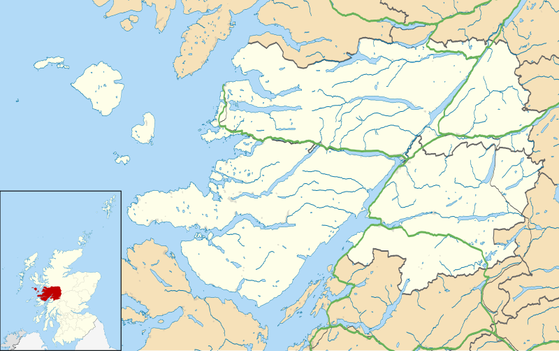
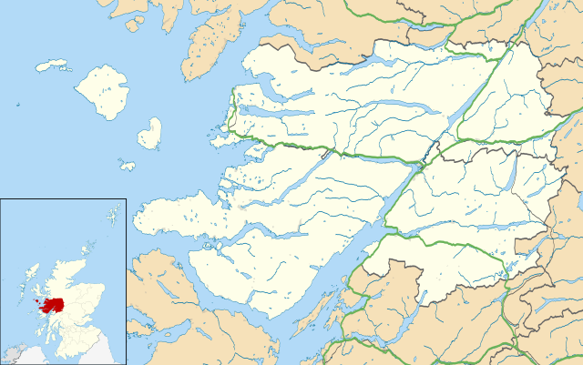
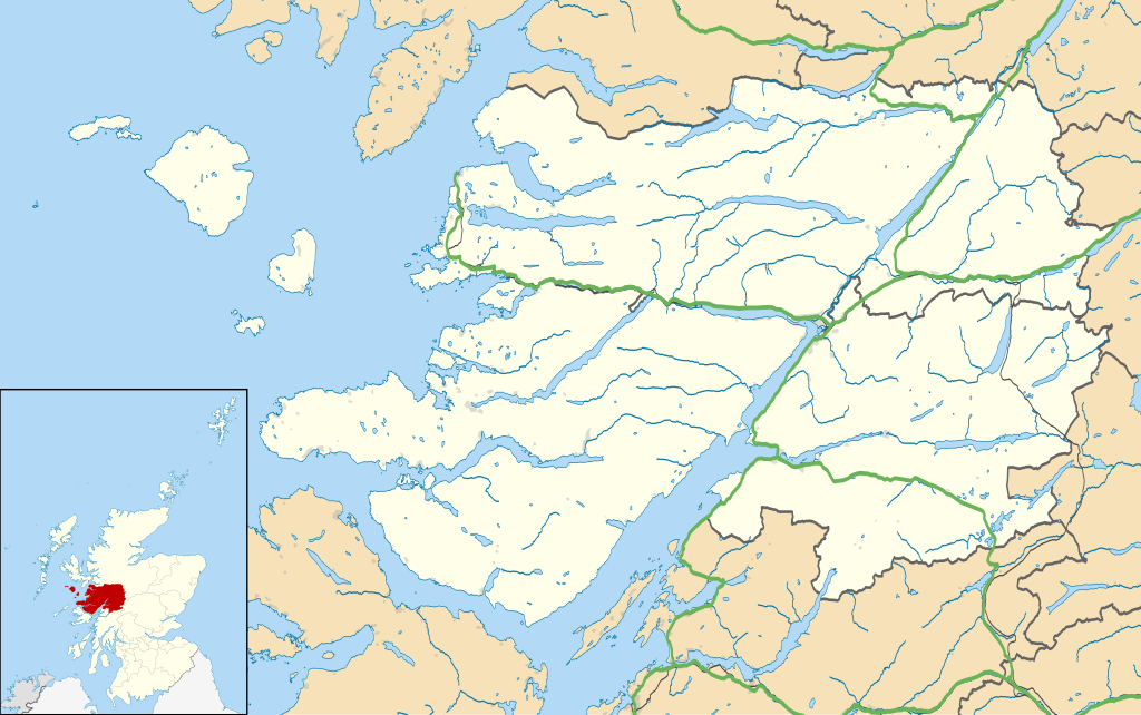
Map of the Lochaber ward management area, UK in 2011, with the following information shown:
Equirectangular map projection on WGS 84 datum, with N/S stretched 180% Geographic limits:
|
| Petsa | |
| Ginkuhaan |
|
| Awtor | Nilfanion, created using Ordnance Survey data |
| Pagtugot (Gin-uutro paggamit inin nga file) |
Ini nga file in nakalisensya ha ilarom han Creative Commons Attribution-Share Alike 3.0 Unported license. Attribution: Contains Ordnance Survey data © Crown copyright and database right
|
| Other versions | File:Lochaber UK blank map.svg - Blank map |
Kaagi han paypay
Pidlita an adlaw/oras para makit-an an fayl nga naggawas hito nga oras.
| Pitsa/Oras | Thumbnail | Mga dimensyon | Gumaramit | Komento | |
|---|---|---|---|---|---|
| waray pa kasasapawi | 14:23, 13 Pebrero 2011 | | 1,425 × 893 (2.39 nga MB) | Nilfanion | {{Information |Description=Map of the Lochaber ward management area, UK in 2011, with the following information shown: *Ward boundaries *Coastline, lakes and rivers *Roads and railways *Urban areas Equirectangular map projection on WGS 84 |
Mga Sumpay
An mga nasunod nga mga pakli nasumpay hini nga paypay:
Global file usage
An masunod nga iba nga mga wiki in nagamit hini nga file:
- Paggamit ha ar.wikipedia.org
- Paggamit ha ceb.wikipedia.org
- Paggamit ha cs.wikipedia.org
- Paggamit ha en.wikipedia.org
- Fort William, Scotland
- Back of Keppoch
- Glencoe, Highland
- Kinlochleven
- Mallaig
- Kilchoan
- Ballachulish
- Glenfinnan
- Onich
- Arisaig
- Morar
- Achnacarry
- Inverie
- Acharacle
- Achintee, Fort William
- Achosnich
- Achriabhach
- Portuairk
- Glenuig
- Laggan, Great Glen
- Morvern
- Banavie
- Lochailort
- Caol
- Aberchalder
- Achaphubuil
- Tarbet, Loch Nevis
- Glenborrodale
- Kilmory, Ardnamurchan
- Invergarry
- Blaich
- Achindarroch
- Alisary
- Ardery
- Ardmolich
- Ardtoe
- Bohuntine
- Bonnavoulin
- Ockle
- Bracora
- Bracorina
- Sanna, Ardnamurchan
- Belford Hospital
- Resipole
- Lochaline
- Roshven
- Achnasaul
Kitaa durudamo nga global usage hinin nga file.