Paypay:Leicestershire UK location map.svg

Size of this PNG preview of this SVG file: 761 × 600 nga mga pixel. Iba nga mga resolusyon: 305 × 240 nga mga pixel | 609 × 480 nga mga pixel | 975 × 768 nga mga pixel | 1,280 × 1,009 nga mga pixel | 2,560 × 2,017 nga mga pixel | 1,425 × 1,123 nga mga pixel.
Orihinal nga paypay (SVG nga fayl, ginbabanabanahan nga 1,425 × 1,123 nga mga pixel, kadako han fayl: 2.23 nga MB)
| Tigtulidong |
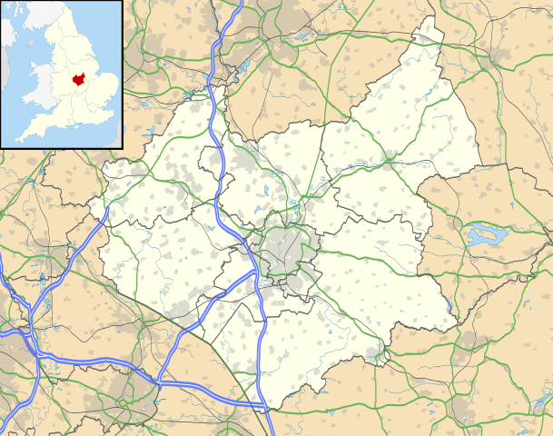
Map of Leicestershire, UK with the following information shown:
Equirectangular map projection on WGS 84 datum, with N/S stretched 160% Geographic limits:
|
| Petsa | |
| Ginkuhaan |
|
| Awtor | Nilfanion, created using Ordnance Survey data |
| Pagtugot (Gin-uutro paggamit inin nga file) |
Ini nga file in nakalisensya ha ilarom han Creative Commons Attribution-Share Alike 3.0 Unported license. Attribution: Contains Ordnance Survey data © Crown copyright and database right
|
| Other versions | File:Leicestershire UK district map (blank).svg - Blank map |
.svg)
Kaagi han paypay
Pidlita an adlaw/oras para makit-an an fayl nga naggawas hito nga oras.
| Pitsa/Oras | Thumbnail | Mga dimensyon | Gumaramit | Komento | |
|---|---|---|---|---|---|
| waray pa kasasapawi | 19:00, 26 Septyembre 2010 | | 1,425 × 1,123 (2.23 nga MB) | Nilfanion | {{Information |Description=Map of Leicestershire, UK with the following information shown: *Administrative borders *Coastline, lakes and rivers *Roads and railways *Urban areas Equirectangular map projection on WGS 84 datum, with N/S |
Mga Sumpay
An mga nasunod nga mga pakli nasumpay hini nga paypay:
Global file usage
An masunod nga iba nga mga wiki in nagamit hini nga file:
- Paggamit ha ar.wikipedia.org
- Paggamit ha bg.wikipedia.org
- Paggamit ha bn.wikipedia.org
- Paggamit ha ceb.wikipedia.org
- Paggamit ha cs.wikipedia.org
- Paggamit ha en.wikipedia.org
- Quorn, Leicestershire
- Walton, Leicestershire
- Belvoir Castle
- Ashby-de-la-Zouch
- Breedon on the Hill
- Kirby Muxloe
- Moira, Leicestershire
- Foxton Locks
- Market Harborough
- Lutterworth
- Ashby de la Zouch Castle
- Donisthorpe
- Loughborough
- Melton Mowbray
- East Midlands Airport
- Wigston
- Hinckley
- Coalville
- Earl Shilton
- Barwell
- Burbage, Leicestershire
- Glenfield, Leicestershire
- Bradgate Park
- Kegworth
- National Space Centre
- Oadby
- Market Bosworth
- Carlton, Leicestershire
- Frisby on the Wreake
- Shepshed
- Blaby
- Cotes, Leicestershire
- Twycross
- Dadlington
- Buckminster
- Sutton Cheney
- Wycomb
- Bruntingthorpe Aerodrome
- Foxton Inclined Plane
Kitaa durudamo nga global usage hinin nga file.