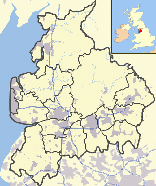
Paypay:Lancashire outline map with UK.png

Kadako hin nga pahiuna nga pagawas: 504 × 600 nga mga pixel. Iba nga mga resolusyon: 202 × 240 nga mga pixel | 600 × 714 nga mga pixel.
Orihinal nga paypay (600 × 714 nga pixel, kadako han fayl: 423 nga KB, MIME nga tipo: image/png)
Kaagi han paypay
Pidlita an adlaw/oras para makit-an an fayl nga naggawas hito nga oras.
| Pitsa/Oras | Thumbnail | Mga dimensyon | Gumaramit | Komento | |
|---|---|---|---|---|---|
| waray pa kasasapawi | 12:11, 25 Hunyo 2008 |  | 600 × 714 (423 nga KB) | Jza84 | Reverted to version as of 13:59, 26 March 2008 |
| 00:35, 25 Hunyo 2008 |  | 600 × 714 (448 nga KB) | Jza84 | Reverted to version as of 13:56, 26 March 2008 - testing darker boundaries | |
| 13:59, 26 Marso 2008 |  | 600 × 714 (423 nga KB) | Jza84 | Reverted to version as of 20:12, 21 June 2007 | |
| 13:56, 26 Marso 2008 |  | 600 × 714 (448 nga KB) | Jza84 | Reverted to version as of 20:32, 19 June 2007 | |
| 20:12, 21 Hunyo 2007 |  | 600 × 714 (423 nga KB) | Jza84 | making some corrections | |
| 20:32, 19 Hunyo 2007 |  | 600 × 714 (448 nga KB) | Jza84 | {{Information |Description= A map of Lancashire, in Source=self-made |Date=19-06-2007 |Author= [[User:Jhamez84|Jhamez84 }} |
Mga Sumpay
Waray pakli nga nagamit hinin nga file.
Global file usage
An masunod nga iba nga mga wiki in nagamit hini nga file:
- Paggamit ha en.wikipedia.org
- Paggamit ha ml.wikipedia.org
- Paggamit ha sv.wikinews.org
- Paggamit ha ug.wikipedia.org