Paypay:Lake District National Park UK location map.svg

Size of this PNG preview of this SVG file: 497 × 599 nga mga pixel. Iba nga mga resolusyon: 199 × 240 nga mga pixel | 398 × 480 nga mga pixel | 637 × 768 nga mga pixel | 850 × 1,024 nga mga pixel | 1,699 × 2,048 nga mga pixel | 1,116 × 1,345 nga mga pixel.
Orihinal nga paypay (SVG nga fayl, ginbabanabanahan nga 1,116 × 1,345 nga mga pixel, kadako han fayl: 1.6 nga MB)
| Tigtulidong |
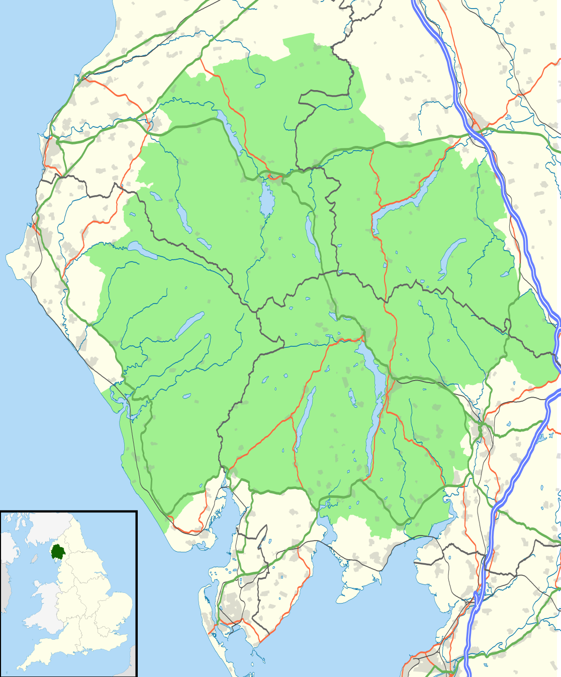
Map of the Lake District National Park, UK with the following information shown:
Equirectangular map projection on WGS 84 datum, with N/S stretched 170% Geographic limits:
|
| Petsa | |
| Ginkuhaan |
Office of National Statistics Geography
|
| Awtor | Nilfanion, created using Ordnance Survey data |
| Pagtugot (Gin-uutro paggamit inin nga file) |
Ini nga file in nakalisensya ha ilarom han Creative Commons Attribution-Share Alike 3.0 Unported license. Attribution: Contains Ordnance Survey data © Crown copyright and database right
|
Kaagi han paypay
Pidlita an adlaw/oras para makit-an an fayl nga naggawas hito nga oras.
| Pitsa/Oras | Thumbnail | Mga dimensyon | Gumaramit | Komento | |
|---|---|---|---|---|---|
| waray pa kasasapawi | 21:05, 4 Agosto 2016 | | 1,116 × 1,345 (1.6 nga MB) | Rcsprinter123 | Amendments per the Lake District National Park (Designation) (Variation) Order 2012. |
| 21:32, 29 Oktubre 2010 |  | 1,108 × 1,345 (1.48 nga MB) | Nilfanion | {{Information |Description=Map of the Lake District National Park, UK with the following information shown: *National Park boundary *Administrative borders *Coastline, lakes and rivers *Roads and railways *Urban areas Equirectangular |
Mga Sumpay
An mga nasunod nga mga pakli nasumpay hini nga paypay:
Global file usage
An masunod nga iba nga mga wiki in nagamit hini nga file:
- Paggamit ha ar.wikipedia.org
- Paggamit ha ban.wikipedia.org
- Paggamit ha br.wikipedia.org
- Paggamit ha ceb.wikipedia.org
- Paggamit ha de.wikipedia.org
- Paggamit ha en.wikipedia.org
- Paggamit ha es.wikipedia.org
- Paggamit ha eu.wikipedia.org
- Paggamit ha fa.wikipedia.org
- Paggamit ha fy.wikipedia.org
- Paggamit ha he.wikipedia.org
- Paggamit ha hy.wikipedia.org
- Paggamit ha ja.wikipedia.org
- Paggamit ha kn.wikipedia.org
- Paggamit ha ml.wikipedia.org
- Paggamit ha mt.wikipedia.org
- Paggamit ha nl.wikipedia.org
- Paggamit ha nl.wikivoyage.org
- Paggamit ha nn.wikipedia.org
- Paggamit ha pl.wikipedia.org
- Paggamit ha ro.wikipedia.org
- Paggamit ha ru.wikipedia.org
- Paggamit ha simple.wikipedia.org
- Paggamit ha si.wikipedia.org
- Paggamit ha sl.wikipedia.org
- Paggamit ha ta.wikipedia.org
- Paggamit ha th.wikipedia.org
- Paggamit ha tr.wikipedia.org
- Paggamit ha uk.wikipedia.org
- Paggamit ha zh.wikipedia.org