Paypay:Italy Sardinia relief location map.svg

Size of this PNG preview of this SVG file: 334 × 599 nga mga pixel. Iba nga mga resolusyon: 134 × 240 nga mga pixel | 267 × 480 nga mga pixel | 428 × 768 nga mga pixel | 571 × 1,024 nga mga pixel | 1,142 × 2,048 nga mga pixel | 601 × 1,078 nga mga pixel.
Orihinal nga paypay (SVG nga fayl, ginbabanabanahan nga 601 × 1,078 nga mga pixel, kadako han fayl: 1.62 nga MB)
Dalikyat nga pulong
| Tigtulidong |
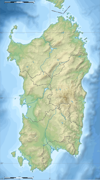
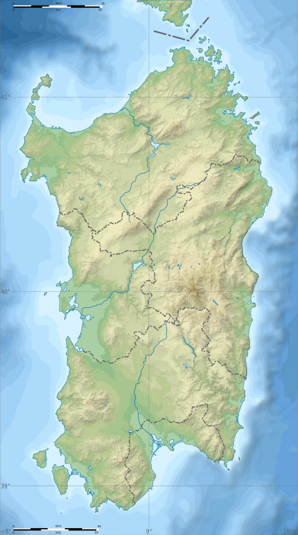
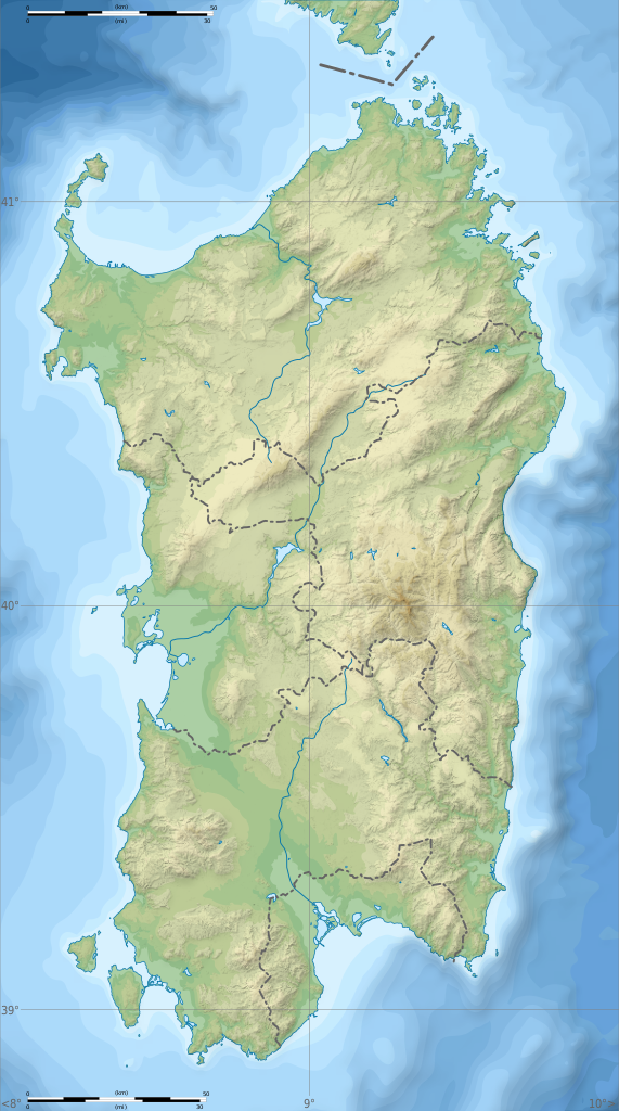
English: Blank physical map of Sardinia, Italy, for geo-location purpose, with province boundaries. Altitude levels : 25m, 50, 100, 200, 400, 600, etc. (same for bathymetry). Français : Carte topographique vierge de la Sardaigne, Italie, destinée à la géolocalisation, avec les limites des provinces. Niveaux d'altitudes : 25 m, 50, 100, 200, 400, 600, etc. Idem pour la bathymétrie.
Geographic limits of the map:
|
| Petsa | (UTC) |
| Ginkuhaan |
Kalugaringon nga buhat
|
| Awtor | Sémhur |
| Other versions |
Derivative works of this file: Aree protette della Sardegna.svg
|
| Attribution (required by the license) | © Sémhur / Wikimedia Commons / |
| SVG | W3C-validity not checked. |
| Atelier graphique |

| Camera location | | View this and other nearby images on: OpenStreetMap |
|---|
Palilisensya:
I, the copyright holder of this work, hereby publish it under the following licenses:
| Copyleft: This work of art is free; you can redistribute it and/or modify it according to terms of the Free Art License. You will find a specimen of this license on the Copyleft Attitude site as well as on other sites. |
This file is licensed under the Creative Commons Attribution-Share Alike Attribution-Share Alike 4.0 International, 3.0 Unported, 2.5 Generic, 2.0 Generic and 1.0 Generic license.
- Talwas ka:
- para han pagpasaro – para han pagkopya, pagpakalat ngan pagpadangat han buhat
- para han pagremix – pag-adapt han buhat
- Ha ilarom an masunod nga mga kondisyon:
- attribution – Kinahanglanon mo tagan hin kaangayan nga credit, paghatag hin sumpay ngadto ha lisensya, ngan igbutang an imo ginbag-ohan nga binuhat. Puydi mo ini buhaton ha bisan ano nga resonable nga pamaagi, pero diri nimo pagawson nga an naghatag hin lisensya nag-eendorso ha imo o ha imo paggamit.
- share alike – Kun imo ginsagol-hin-otro, gin-iba, o gin-hingayad han buhat, ikaw in angay gud là magpakalat han imo gin-amot ha ilarom la han [http:creativecommons.org/share-your-work/licensing-considerations/compatible-licenses pareho o naangay nga lisensya] sugad han orihinal.
Puydi ka pumili hin lisenysa nga karuyag mo.
Kaagi han paypay
Pidlita an adlaw/oras para makit-an an fayl nga naggawas hito nga oras.
| Pitsa/Oras | Thumbnail | Mga dimensyon | Gumaramit | Komento | |
|---|---|---|---|---|---|
| waray pa kasasapawi | 15:26, 4 Marso 2018 | | 601 × 1,078 (1.62 nga MB) | Ruthven | c:User:Rillke/bigChunkedUpload.js: |
| 09:29, 25 Pebrero 2018 |  | 601 × 1,078 (1.62 nga MB) | Ruthven | New province boundaries (2016) | |
| 15:29, 24 Enero 2010 |  | 601 × 1,078 (1.63 nga MB) | Sémhur | == {{int:filedesc}} == {{Information |Description= {{en|Blank physical map of Sardinia, Italy, for geo-location purpose, with province boundaries. Altitude levels : 25m, 50, 100, 200, 400, 600, etc. (same for bathymetry)}} {{fr|Carte topo |
Mga Sumpay
An mga nasunod nga mga pakli nasumpay hini nga paypay:
Global file usage
An masunod nga iba nga mga wiki in nagamit hini nga file:
- Paggamit ha ar.wikipedia.org
- Paggamit ha az.wikipedia.org
- Paggamit ha ba.wikipedia.org
- Paggamit ha be.wikipedia.org
- Paggamit ha bn.wikipedia.org
- Paggamit ha bs.wikipedia.org
- Paggamit ha ca.wikipedia.org
- Paggamit ha ceb.wikipedia.org
- Paggamit ha ce.wikipedia.org
- Paggamit ha cs.wikipedia.org
- Paggamit ha de.wikipedia.org
- Paggamit ha de.wikivoyage.org
- Paggamit ha dsb.wikipedia.org
- Paggamit ha en.wikipedia.org
- Lake Gusana
- Punta Sardegna
- Languages of Italy
- Santo Stefano (island)
- San Pietro Island
- Punta La Marmora
- Budelli
- Mechanized Brigade "Sassari"
- Lake Baratz
- 184th Paratroopers Division "Nembo"
- 203rd Coastal Division (Italy)
- 204th Coastal Division (Italy)
- 205th Coastal Division (Italy)
- Lake Coghinas
- Lake Omodeo
- Lake Liscia
- Template:Sardinia regional languages labelled map
- Module:Location map/data/Italy Sardinia/doc
- Gulf of Oristano
- User:Michael!/Project:Location map templates/Italy
- Lake Temo
- Is Molas Challenge
- Is Molas Senior Open
- Module:Location map/data/Italy Sardinia
Kitaa durudamo nga global usage hinin nga file.