Paypay:Iran location map.svg

Size of this PNG preview of this SVG file: 672 × 600 nga mga pixel. Iba nga mga resolusyon: 269 × 240 nga mga pixel | 538 × 480 nga mga pixel | 861 × 768 nga mga pixel | 1,147 × 1,024 nga mga pixel | 2,295 × 2,048 nga mga pixel | 1,200 × 1,071 nga mga pixel.
Orihinal nga paypay (SVG nga fayl, ginbabanabanahan nga 1,200 × 1,071 nga mga pixel, kadako han fayl: 299 nga KB)
Dalikyat nga pulong
| Tigtulidong |
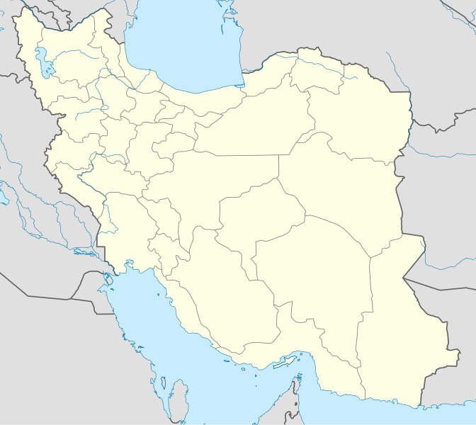
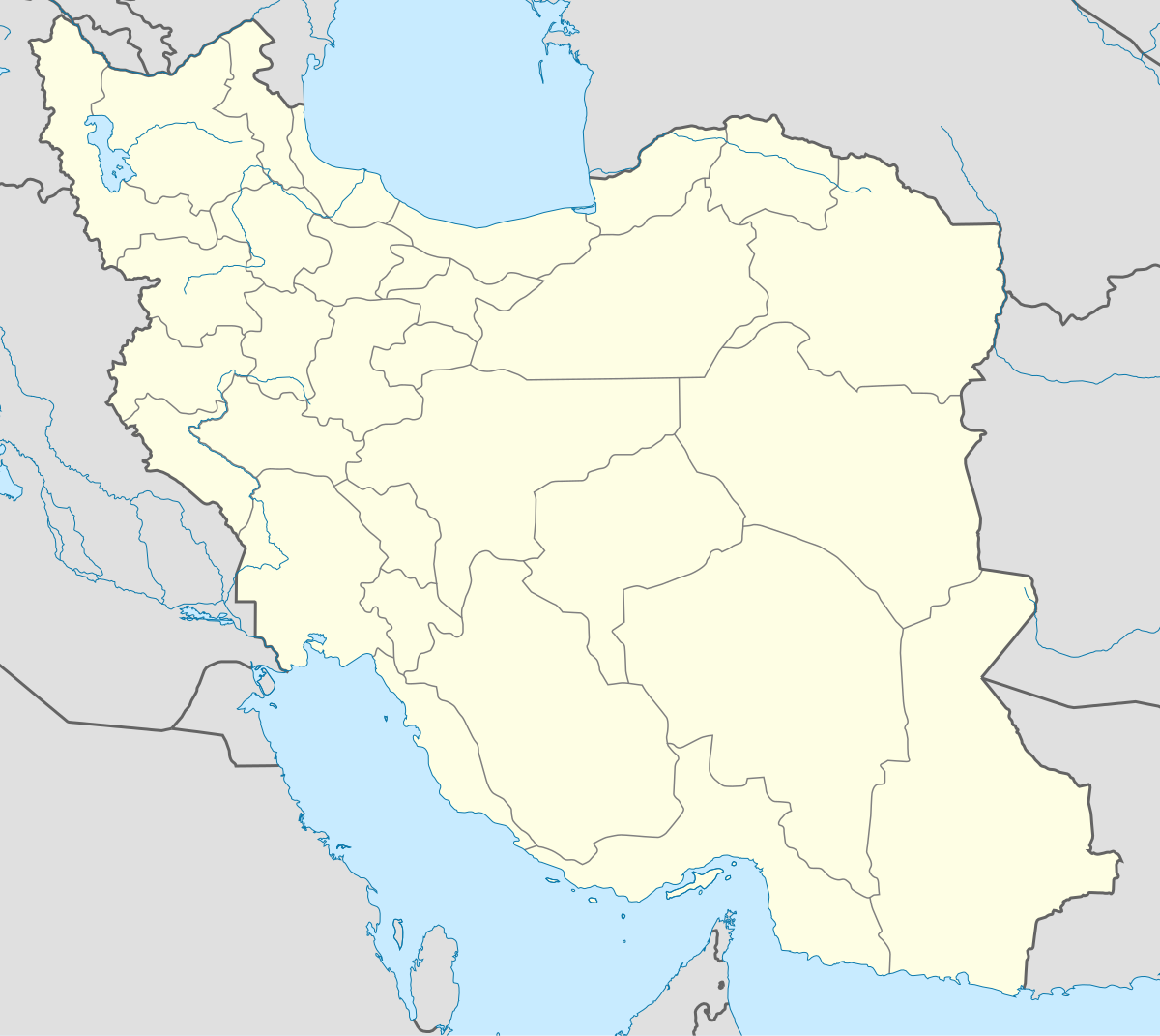
English: Location map of Iran.
Equirectangular projection. Stretched by 118.0%. Geographic limits of the map: * N: 40.0° N * S: 24.5° N * W: 43.5° E * E: 64.0° EMade with Natural Earth. Free vector and raster map data @ naturalearthdata.com. |
| Petsa | |
| Ginkuhaan | Kalugaringon nga buhat |
| Awtor | Uwe Dedering |
| Other versions |
Derivative works of this file:
|
| SVG genesis | This W3C-invalid map was created with Adobe Illustrator, and with Inkscape. |

Palilisensya:
I, the copyright holder of this work, hereby publish it under the following licenses:
Ini nga file in nakalisensya ha ilarom han Creative Commons Attribution-Share Alike 3.0 Unported license.
- Talwas ka:
- para han pagpasaro – para han pagkopya, pagpakalat ngan pagpadangat han buhat
- para han pagremix – pag-adapt han buhat
- Ha ilarom an masunod nga mga kondisyon:
- attribution – Kinahanglanon mo tagan hin kaangayan nga credit, paghatag hin sumpay ngadto ha lisensya, ngan igbutang an imo ginbag-ohan nga binuhat. Puydi mo ini buhaton ha bisan ano nga resonable nga pamaagi, pero diri nimo pagawson nga an naghatag hin lisensya nag-eendorso ha imo o ha imo paggamit.
- share alike – Kun imo ginsagol-hin-otro, gin-iba, o gin-hingayad han buhat, ikaw in angay gud là magpakalat han imo gin-amot ha ilarom la han [http:creativecommons.org/share-your-work/licensing-considerations/compatible-licenses pareho o naangay nga lisensya] sugad han orihinal.

|
An permiso in ginhatag ha pagkopya, pagpakalat ngan/o pagliwat hinin nga dokumento ha ilarom han mga termino han GNU Free Documentation License, Version 1.2 o mas uruurhi nga version nga ginmantala han Free Software Foundation; nga may-ada waray Invariant Sections, waray Front-Cover Texts, ngan waray Back-Cover Texts. May-ada kopya hin lisensya nga ginlalakip ha seksyon nga may-ada pamagat nga GNU Free Documentation License. |
Puydi ka pumili hin lisenysa nga karuyag mo.
Kaagi han paypay
Pidlita an adlaw/oras para makit-an an fayl nga naggawas hito nga oras.
| Pitsa/Oras | Thumbnail | Mga dimensyon | Gumaramit | Komento | |
|---|---|---|---|---|---|
| waray pa kasasapawi | 07:59, 22 Oktubre 2013 | | 1,200 × 1,071 (299 nga KB) | NordNordWest | Reverted to version as of 17:55, 15 April 2013; no reason for change given |
| 13:44, 21 Oktubre 2013 |  | 1,200 × 1,071 (640 nga KB) | Ekivalan | Reverted to version as of 17:38, 12 April 2013 | |
| 13:43, 21 Oktubre 2013 |  | 1,200 × 1,071 (640 nga KB) | Ekivalan | Reverted to version as of 17:38, 12 April 2013 | |
| 17:55, 15 Abril 2013 |  | 1,200 × 1,071 (299 nga KB) | NordNordWest | according to http://images.persianblog.ir/516041_B0b76ypr.jpg + Tabas -> South Khorasan province | |
| 17:40, 12 Abril 2013 |  | 1,200 × 1,071 (640 nga KB) | Yamaha5 | Reverted to version as of 20:08, 11 July 2010 | |
| 17:38, 12 Abril 2013 |  | 1,200 × 1,071 (640 nga KB) | Yamaha5 | Reverted to version as of 20:08, 11 July 2010 in all maps khorasan is like past! | |
| 11:30, 17 Marso 2013 |  | 1,200 × 1,071 (294 nga KB) | NordNordWest | upd | |
| 20:08, 11 Hulyo 2010 |  | 1,200 × 1,071 (640 nga KB) | Uwe Dedering | 31. province Alborz | |
| 17:44, 18 Pebrero 2010 |  | 1,200 × 1,071 (705 nga KB) | Uwe Dedering | Bahrain above water, no disputed countries | |
| 13:00, 18 Pebrero 2010 |  | 1,200 × 1,071 (709 nga KB) | Uwe Dedering | {{Information |Description={{en|1=Location map of Iran. Equirectangular projection. Strechted by 118.0%. Geographic limits of the map: * N: 40.0° N * S: 24.5° N * W: 43.5° E * E: 64.0° E Made with Natural Earth. Free vector and raster map data @ |
Mga Sumpay
An mga nasunod nga mga pakli nasumpay hini nga paypay:
Global file usage
An masunod nga iba nga mga wiki in nagamit hini nga file:
- Paggamit ha af.wikipedia.org
- Paggamit ha als.wikipedia.org
- Paggamit ha an.wikipedia.org
- Paggamit ha ar.wikipedia.org
- محمد بن إسماعيل البخاري
- طهران
- صحيح مسلم
- محافظات إيران
- فخر الدين الرازي
- كأس آسيا 1968
- كأس آسيا 1976
- مسلم بن الحجاج
- قالب:خريطة مواقع إیران
- مشهد
- زلزال بم 2003
- تفجيرات زاهدان 2010
- زلزال طبس 1978
- بطولة آسيا للناشئين تحت 16 عاما 2012
- قائمة المفكرين المسيحيين في العلم
- مرتضى الأنصاري
- زلزال تبريز 2012
- شعيطة (رامشير)
Kitaa durudamo nga global usage hinin nga file.