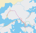
Paypay:Hong Kong Railway Route Map blank.svg

Size of this PNG preview of this SVG file: 655 × 599 nga mga pixel. Iba nga mga resolusyon: 262 × 240 nga mga pixel | 525 × 480 nga mga pixel | 839 × 768 nga mga pixel | 1,119 × 1,024 nga mga pixel | 2,238 × 2,048 nga mga pixel | 1,038 × 950 nga mga pixel.
Orihinal nga paypay (SVG nga fayl, ginbabanabanahan nga 1,038 × 950 nga mga pixel, kadako han fayl: 23 nga KB)
Kaagi han paypay
Pidlita an adlaw/oras para makit-an an fayl nga naggawas hito nga oras.
| Pitsa/Oras | Thumbnail | Mga dimensyon | Gumaramit | Komento | |
|---|---|---|---|---|---|
| waray pa kasasapawi | 01:02, 15 Mayo 2022 |  | 1,038 × 950 (23 nga KB) | Jc86035 | East Rail Line cross-harbour extension |
| 08:29, 29 Hunyo 2021 |  | 1,038 × 950 (23 nga KB) | Sameboat | Tuen Ma Line and Airport island expansion | |
| 00:07, 21 Hunyo 2020 |  | 1,038 × 950 (23 nga KB) | Sameboat | Tuen Ma line | |
| 14:12, 31 Disyembre 2016 |  | 1,038 × 950 (22 nga KB) | Jc86035 | line colours | |
| 10:14, 29 Disyembre 2016 |  | 1,038 × 950 (22 nga KB) | Jc86035 | fixed | |
| 13:45, 28 Disyembre 2016 |  | 1,038 × 950 (25 nga KB) | Nv7801 | Added South Island Line | |
| 06:02, 29 Oktubre 2016 |  | 1,038 × 950 (22 nga KB) | Jc86035 | KTE moved 2px | |
| 04:52, 29 Oktubre 2016 |  | 1,038 × 950 (22 nga KB) | Jc86035 | m | |
| 04:49, 29 Oktubre 2016 |  | 1,038 × 950 (22 nga KB) | Jc86035 | m | |
| 04:42, 29 Oktubre 2016 |  | 1,038 × 950 (22 nga KB) | Jc86035 | again |
Mga Sumpay
An mga nasunod nga mga pakli nasumpay hini nga paypay:
Global file usage
An masunod nga iba nga mga wiki in nagamit hini nga file:
- Paggamit ha ar.wikipedia.org
- Paggamit ha as.wikipedia.org
- Paggamit ha az.wikipedia.org
- Paggamit ha bh.wikipedia.org
- Paggamit ha ca.wikipedia.org
- Paggamit ha ceb.wikipedia.org
- Paggamit ha cs.wikipedia.org
- Paggamit ha da.wikipedia.org
- Paggamit ha diq.wikipedia.org
- Paggamit ha en.wikipedia.org
- Yuen Long station
- Tsuen Wan West station
- Kam Sheung Road station
- Tsuen Wan station
- Mei Foo station
- Lai King station
- Lai Chi Kok station
- Cheung Sha Wan station
- Sham Shui Po station
- Kwai Fong station
- Tai Wo Hau station
- Kwai Hing station
- Prince Edward station
- Mong Kok station
- Yau Ma Tei station
- University station (MTR)
- Tuen Mun station
- Siu Hong station
- Tin Shui Wai station
- Long Ping station
- Nam Cheong station
- Po Lam station
- Hang Hau station
- Tseung Kwan O station
- Tiu Keng Leng station
- Sunny Bay station
- Tai Po Market station
- Hong Kong Railway Museum
- Central station (MTR)
- East Tsim Sha Tsui station
- Tsing Yi station
- Admiralty station (MTR)
- Diamond Hill station
Kitaa durudamo nga global usage hinin nga file.