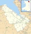
Paypay:Flintshire UK location map.svg

Size of this PNG preview of this SVG file: 541 × 600 nga mga pixel. Iba nga mga resolusyon: 216 × 240 nga mga pixel | 433 × 480 nga mga pixel | 693 × 768 nga mga pixel | 924 × 1,024 nga mga pixel | 1,847 × 2,048 nga mga pixel | 1,177 × 1,305 nga mga pixel.
Orihinal nga paypay (SVG nga fayl, ginbabanabanahan nga 1,177 × 1,305 nga mga pixel, kadako han fayl: 758 nga KB)
Kaagi han paypay
Pidlita an adlaw/oras para makit-an an fayl nga naggawas hito nga oras.
| Pitsa/Oras | Thumbnail | Mga dimensyon | Gumaramit | Komento | |
|---|---|---|---|---|---|
| waray pa kasasapawi | 19:33, 26 Septyembre 2010 |  | 1,177 × 1,305 (758 nga KB) | Nilfanion | {{Information |Description=Blank map of Flintshire, UK with the following information shown: *Administrative borders *Coastline, lakes and rivers *Roads and railways *Urban areas Equirectangular map projection on WGS 84 datum, with N/S s |
Mga Sumpay
An mga nasunod nga mga pakli nasumpay hini nga paypay:
Global file usage
An masunod nga iba nga mga wiki in nagamit hini nga file:
- Paggamit ha ar.wikipedia.org
- Paggamit ha ceb.wikipedia.org
- Paggamit ha cy.wikipedia.org
- Paggamit ha da.wikipedia.org
- Paggamit ha en.wikipedia.org
- List of monastic houses in Wales
- Hawarden
- Flintshire
- Flint, Flintshire
- Buckley, Flintshire
- Holywell, Flintshire
- Mold, Flintshire
- Queensferry, Flintshire
- Mostyn
- Shotton, Flintshire
- Point of Ayr
- Caergwrle
- Ewloe
- Northop Hall
- Talacre
- Caerwys
- Abermorddu
- Afonwen
- Mynydd Isa
- Sealand, Flintshire
- Bagillt
- Ogof Hesp Alyn
- Ogof Hen Ffynhonnau
- Pentre Halkyn
- Moel y Parc transmitting station
- Northop
- Broughton, Flintshire
- Sychdyn
- Dee Estuary
- Penyffordd
- Higher Kinnerton
- Hope, Flintshire
- Leeswood
- Treuddyn
- Nannerch
- Mancot
- Hawarden Airport
- Cilcain
- Rhosesmor
- Halkyn
- Aston Park, Flintshire
- Babell
- Gwernymynydd
- Pantymwyn
- Brynford
- Ysceifiog
Kitaa durudamo nga global usage hinin nga file.