Paypay:Falkland Islands location map.svg

Size of this PNG preview of this SVG file: 737 × 600 nga mga pixel. Iba nga mga resolusyon: 295 × 240 nga mga pixel | 590 × 480 nga mga pixel | 944 × 768 nga mga pixel | 1,258 × 1,024 nga mga pixel | 2,516 × 2,048 nga mga pixel | 1,134 × 923 nga mga pixel.
Orihinal nga paypay (SVG nga fayl, ginbabanabanahan nga 1,134 × 923 nga mga pixel, kadako han fayl: 138 nga KB)
Dalikyat nga pulong
| Description |
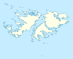
Deutsch: Positionskarte der Falklandinseln
Quadratische Plattkarte, N-S-Streckung 155 %. Geographische Begrenzung der Karte:
English: Location map of the Falkland Islands
Equirectangular projection, N/S stretching 155 %. Geographic limits of the map:
|
|||||||||
| Petsa | ||||||||||
| Ginkuhaan | own work, using United States National Imagery and Mapping Agency data | |||||||||
| Creator | ||||||||||
| Geotemporal data | ||||||||||
| Bounding box |
|
|||||||||
| Georeferencing | If inappropriate please set warp_status = skip to hide. | |||||||||
| Other versions |
Derivative works of this file: |
|||||||||

|
This map has been made or improved in the German Kartenwerkstatt (Map Lab). You can propose maps to improve as well.
|
Palilisensya:
I, the copyright holder of this work, hereby publish it under the following licenses:

|
An permiso in ginhatag ha pagkopya, pagpakalat ngan/o pagliwat hinin nga dokumento ha ilarom han mga termino han GNU Free Documentation License, Version 1.2 o mas uruurhi nga version nga ginmantala han Free Software Foundation; nga may-ada waray Invariant Sections, waray Front-Cover Texts, ngan waray Back-Cover Texts. May-ada kopya hin lisensya nga ginlalakip ha seksyon nga may-ada pamagat nga GNU Free Documentation License. |
This file is licensed under the Creative Commons Attribution 3.0 Unported license.
- Talwas ka:
- para han pagpasaro – para han pagkopya, pagpakalat ngan pagpadangat han buhat
- para han pagremix – pag-adapt han buhat
- Ha ilarom an masunod nga mga kondisyon:
- attribution – Kinahanglanon mo tagan hin kaangayan nga credit, paghatag hin sumpay ngadto ha lisensya, ngan igbutang an imo ginbag-ohan nga binuhat. Puydi mo ini buhaton ha bisan ano nga resonable nga pamaagi, pero diri nimo pagawson nga an naghatag hin lisensya nag-eendorso ha imo o ha imo paggamit.
Puydi ka pumili hin lisenysa nga karuyag mo.
Kaagi han paypay
Pidlita an adlaw/oras para makit-an an fayl nga naggawas hito nga oras.
| Pitsa/Oras | Thumbnail | Mga dimensyon | Gumaramit | Komento | |
|---|---|---|---|---|---|
| waray pa kasasapawi | 12:00, 15 Marso 2009 | | 1,134 × 923 (138 nga KB) | NordNordWest | {{Information |Description= {{de|Positionskarte der Falklandinseln}} Quadratische Plattkarte, N-S-Streckung 155 %. Geographische Begrenzung der Karte: * N: 50.9° S * S: 53.0° S * W: 61.5° W * O: 57.5° W {{en|Location map of the |
Mga Sumpay
An mga nasunod nga mga pakli nasumpay hini nga paypay:
Global file usage
An masunod nga iba nga mga wiki in nagamit hini nga file:
- Paggamit ha af.wikipedia.org
- Paggamit ha an.wikipedia.org
- Paggamit ha ar.wikipedia.org
- Paggamit ha ast.wikipedia.org
- Paggamit ha az.wikipedia.org
- Paggamit ha ba.wikipedia.org
- Paggamit ha be-tarask.wikipedia.org
- Paggamit ha be.wikipedia.org
- Paggamit ha bg.wikipedia.org
- Paggamit ha bn.wikipedia.org
- Paggamit ha ca.wikipedia.org
- Paggamit ha ceb.wikipedia.org
- Plantilya:Location map United Kingdom Falkland Islands
- William Point
- Sandy Island
- Saddle Hill
- Rat Island
- Rabbit Island
- Low Bay
- Long Island
- Green Island
- Green Islet
- Goat Point
- Castle Hill
- Bird Island
- Mount Pleasant
- North Point
- Hospital Point
- Castle Rock
- West Point
- Little Island
- Black Point
- North Beach
- Sail Rock
- Black Rock
- High Rock
- Hut Point
- East Point
- Wolf Rock
- White Rock
- White Point
- Whale Point
Kitaa durudamo nga global usage hinin nga file.