Paypay:Costa Rica relief location map.jpg

Kadako hin nga pahiuna nga pagawas: 666 × 600 nga mga pixel. Iba nga mga resolusyon: 267 × 240 nga mga pixel | 533 × 480 nga mga pixel | 853 × 768 nga mga pixel | 1,148 × 1,034 nga mga pixel.
Orihinal nga paypay (1,148 × 1,034 nga pixel, kadako han fayl: 841 nga KB, MIME nga tipo: image/jpeg)
Dalikyat nga pulong
| Camera location | | View this and other nearby images on: OpenStreetMap |
|---|
| Tigtulidong |
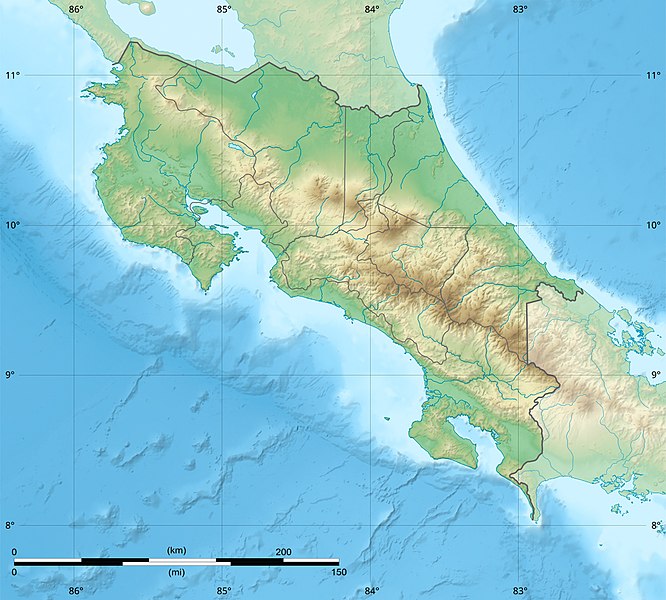
English: Blank relief map of Costa Rica for geo-location purpose.
Note : The Isla del Coco, out of the map, is not shown. Scale : 1:1,856,000 (accuracy : 464 m) Français : Carte du relief vierge du Costa Rica destinée à la géolocalisation.
Note : L´Isla del Coco, hors carte, n'est pas représentée. Échelle : 1:1 856 000 (précision : 464 m) Equirectangular projection centered on 9° 30' N – 84° 15' W, WGS84 datum * West : 86° 30' W * East : 82° W * North : 11° 30' N * South : 7° 30' N |
||
| Petsa | 2008-06, updated 2022-03 | ||
| Ginkuhaan |
Kalugaringon nga buhat
|
||
| Awtor | Eric Gaba (Sting - fr:Sting) | ||
| Pagtugot (Gin-uutro paggamit inin nga file) |
|
||
| Other versions |
|

Palilisensya:
Eric Gaba (user Sting) for Wikimedia Commons using GEBCO_2021 Grid data, the copyright holder of this work, hereby publishes it under the following licenses:

|
An permiso in ginhatag ha pagkopya, pagpakalat ngan/o pagliwat hinin nga dokumento ha ilarom han mga termino han GNU Free Documentation License, Version 1.2 o mas uruurhi nga version nga ginmantala han Free Software Foundation; nga may-ada waray Invariant Sections, waray Front-Cover Texts, ngan waray Back-Cover Texts. May-ada kopya hin lisensya nga ginlalakip ha seksyon nga may-ada pamagat nga GNU Free Documentation License. |
This file is licensed under the Creative Commons Attribution-Share Alike Attribution-Share Alike 4.0 International, 3.0 Unported, 2.5 Generic, 2.0 Generic and 1.0 Generic license.
Attribution: Eric Gaba (user Sting) for Wikimedia Commons using GEBCO_2021 Grid data
- Talwas ka:
- para han pagpasaro – para han pagkopya, pagpakalat ngan pagpadangat han buhat
- para han pagremix – pag-adapt han buhat
- Ha ilarom an masunod nga mga kondisyon:
- attribution – Kinahanglanon mo tagan hin kaangayan nga credit, paghatag hin sumpay ngadto ha lisensya, ngan igbutang an imo ginbag-ohan nga binuhat. Puydi mo ini buhaton ha bisan ano nga resonable nga pamaagi, pero diri nimo pagawson nga an naghatag hin lisensya nag-eendorso ha imo o ha imo paggamit.
- share alike – Kun imo ginsagol-hin-otro, gin-iba, o gin-hingayad han buhat, ikaw in angay gud là magpakalat han imo gin-amot ha ilarom la han [http:creativecommons.org/share-your-work/licensing-considerations/compatible-licenses pareho o naangay nga lisensya] sugad han orihinal.
Puydi ka pumili hin lisenysa nga karuyag mo.
Kaagi han paypay
Pidlita an adlaw/oras para makit-an an fayl nga naggawas hito nga oras.
| Pitsa/Oras | Thumbnail | Mga dimensyon | Gumaramit | Komento | |
|---|---|---|---|---|---|
| waray pa kasasapawi | 22:51, 30 Marso 2022 | | 1,148 × 1,034 (841 nga KB) | Sting | New map using new data |
| 01:32, 4 Nobyembre 2021 |  | 1,148 × 1,034 (906 nga KB) | RoboQwezt0x7CB | hand edited to remove non-existing waterbodies, used lower elevation green shade to bucket fill (best I can do without the tools to generate the map) particulary in the south of the country (probably an altitude render/clipping error), kept some that are hydroelectric plant's reservoirs | |
| 12:11, 19 Hulyo 2010 |  | 1,148 × 1,034 (500 nga KB) | Sting | Color profile | |
| 15:05, 30 Hulyo 2008 |  | 1,148 × 1,034 (491 nga KB) | Sting | - border | |
| 14:40, 13 Hunyo 2008 |  | 1,148 × 1,034 (499 nga KB) | Sting | Several improvements | |
| 01:21, 12 Hunyo 2008 |  | 1,148 × 1,034 (501 nga KB) | Sting | Correction on shaded layer | |
| 01:09, 12 Hunyo 2008 |  | 1,148 × 1,034 (504 nga KB) | Sting | == Summary == {{Location|10|00|00|N|84|00|00|W|scale:2000000}} <br/> {{Information |Description={{en|Blank relief map of Costa Rica for geo-location purpose.<br/>''Note :'' The ''Isla del Coco'', out of the map, is not shown.<br/>Scale |
Mga Sumpay
An mga nasunod nga mga pakli nasumpay hini nga paypay:
Global file usage
An masunod nga iba nga mga wiki in nagamit hini nga file:
- Paggamit ha ar.wikipedia.org
- Paggamit ha ast.wikipedia.org
- Paggamit ha azb.wikipedia.org
- Paggamit ha az.wikipedia.org
- Paggamit ha ban.wikipedia.org
- Paggamit ha ba.wikipedia.org
- Paggamit ha be.wikipedia.org
- Paggamit ha bg.wikipedia.org
- Paggamit ha bn.wikipedia.org
- Paggamit ha bs.wikipedia.org
- Paggamit ha ca.wikipedia.org
- Paggamit ha ceb.wikipedia.org
- Paggamit ha ce.wikipedia.org
- Paggamit ha ckb.wikipedia.org
- Paggamit ha cs.wikipedia.org
Kitaa durudamo nga global usage hinin nga file.