Paypay:Chicago locator map.png

Kadako hin nga pahiuna nga pagawas: 570 × 600 nga mga pixel. Iba nga mga resolusyon: 228 × 240 nga mga pixel | 615 × 647 nga mga pixel.
Orihinal nga paypay (615 × 647 nga pixel, kadako han fayl: 406 nga KB, MIME nga tipo: image/png)
Dalikyat nga pulong
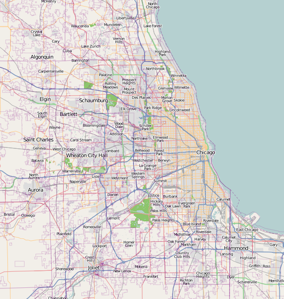
| Tigtulidong | A map of Chicago, IL, and the surrounding area |
| Petsa | |
| Ginkuhaan | Base map generated by OpenStreetMap.org |
| Awtor | Dudemanfellabra |
| Pagtugot (Gin-uutro paggamit inin nga file) |
OpenStreetMap license |
| Other versions | Derivative works of this file: Chicago map LSD.png |

|
This city map image could be re-created using vector graphics as an SVG file. This has several advantages; see Commons:Media for cleanup for more information. If an SVG form of this image is available, please upload it and afterwards replace this template with
{{vector version available|new image name}}.
It is recommended to name the SVG file “Chicago locator map.svg”—then the template Vector version available (or Vva) does not need the new image name parameter. |
Palilisensya:
This file is licensed under the Creative Commons Attribution-Share Alike 2.0 Generic license.
- Talwas ka:
- para han pagpasaro – para han pagkopya, pagpakalat ngan pagpadangat han buhat
- para han pagremix – pag-adapt han buhat
- Ha ilarom an masunod nga mga kondisyon:
- attribution – Kinahanglanon mo tagan hin kaangayan nga credit, paghatag hin sumpay ngadto ha lisensya, ngan igbutang an imo ginbag-ohan nga binuhat. Puydi mo ini buhaton ha bisan ano nga resonable nga pamaagi, pero diri nimo pagawson nga an naghatag hin lisensya nag-eendorso ha imo o ha imo paggamit.
- share alike – Kun imo ginsagol-hin-otro, gin-iba, o gin-hingayad han buhat, ikaw in angay gud là magpakalat han imo gin-amot ha ilarom la han [http:creativecommons.org/share-your-work/licensing-considerations/compatible-licenses pareho o naangay nga lisensya] sugad han orihinal.
Kaagi han paypay
Pidlita an adlaw/oras para makit-an an fayl nga naggawas hito nga oras.
| Pitsa/Oras | Thumbnail | Mga dimensyon | Gumaramit | Komento | |
|---|---|---|---|---|---|
| waray pa kasasapawi | 18:00, 27 Pebrero 2017 | | 615 × 647 (406 nga KB) | Jeanjung212 | Lossless Compressed/optimized png decreasing file size by 59696 bytes |
| 22:49, 5 Enero 2010 |  | 615 × 647 (464 nga KB) | Dudemanfellabra | {{Information |Description={{en|1=A map of Chicago, IL, and the surrounding area}} |Source={{own}} |Author=Dudemanfellabra |Date=2010-01-05 |Permission= |other_versions= }} Category:Maps of Chicago |
Mga Sumpay
An mga nasunod nga mga pakli nasumpay hini nga paypay:
Global file usage
An masunod nga iba nga mga wiki in nagamit hini nga file:
- Paggamit ha af.wikipedia.org
- Paggamit ha ar.wikipedia.org
- Paggamit ha bn.wikipedia.org
- Paggamit ha ceb.wikipedia.org
- Paggamit ha en.wikipedia.org
- Fort Dearborn
- John Hancock Center
- Aon Center (Chicago)
- Saint Valentine's Day Massacre
- Navy Pier
- Alsip, Illinois
- Bartlett, Illinois
- Buffalo Grove, Illinois
- Elgin, Illinois
- Hoffman Estates, Illinois
- Olympia Fields, Illinois
- Aurora, Illinois
- Bolingbrook, Illinois
- Carol Stream, Illinois
- Naperville, Illinois
- Carpentersville, Illinois
- Joliet, Illinois
- Oswego, Illinois
- Lake Forest, Illinois
- German submarine U-505
- Northwestern University
- Field Museum of Natural History
- Symphony Center
- Garfield Park (Chicago)
- Robie House
- Mundelein College
- SeatGeek Stadium
- Willits House
- Graceland Cemetery
- Maine North High School
- Two Prudential Plaza
- 900 North Michigan
- Chase Tower (Chicago)
- Park Tower (Chicago)
- The Palmer House Hilton
- Rosehill Cemetery
- St. Ignatius College Prep
- Bryn Mawr Historic District
- Edgewater Beach Hotel
- The Levee, Chicago
- Palmer Park (Chicago)
Kitaa durudamo nga global usage hinin nga file.