Paypay:Cherkasy province physical map.svg

Size of this PNG preview of this SVG file: 532 × 446 nga mga pixel. Iba nga mga resolusyon: 286 × 240 nga mga pixel | 573 × 480 nga mga pixel | 916 × 768 nga mga pixel | 1,222 × 1,024 nga mga pixel | 2,443 × 2,048 nga mga pixel.
Orihinal nga paypay (SVG nga fayl, ginbabanabanahan nga 532 × 446 nga mga pixel, kadako han fayl: 666 nga KB)
Dalikyat nga pulong
| Tigtulidong |
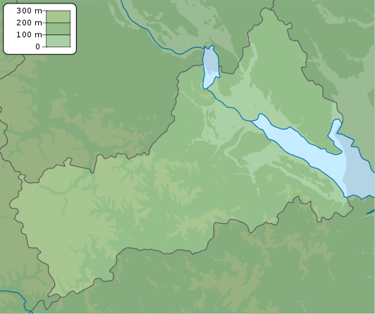
English: Physical map of Cherkasy province, Ukraine
Русский: Физическая карта Черкасской области, Украина |
| Petsa | |
| Ginkuhaan | Kalugaringon nga buhat |
| Awtor | Urutseg |
| SVG genesis | This locator map was created with Inkscape. |
Palilisensya:
| I, the copyright holder of this work, release this work into the public domain. This applies worldwide. In some countries this may not be legally possible; if so: I grant anyone the right to use this work for any purpose, without any conditions, unless such conditions are required by law. |
Kaagi han paypay
Pidlita an adlaw/oras para makit-an an fayl nga naggawas hito nga oras.
| Pitsa/Oras | Thumbnail | Mga dimensyon | Gumaramit | Komento | |
|---|---|---|---|---|---|
| waray pa kasasapawi | 18:05, 22 Disyembre 2010 | | 532 × 446 (666 nga KB) | Urutseg |
Mga Sumpay
An mga nasunod nga mga pakli nasumpay hini nga paypay:
Global file usage
An masunod nga iba nga mga wiki in nagamit hini nga file:
- Paggamit ha ar.wikipedia.org
- Paggamit ha be.wikipedia.org
- Paggamit ha bg.wikipedia.org
- Paggamit ha ceb.wikipedia.org
- Paggamit ha ce.wikipedia.org
- Paggamit ha da.wikipedia.org
- Paggamit ha de.wikipedia.org
- Paggamit ha en.wikipedia.org
- Paggamit ha eo.wikipedia.org
- Paggamit ha es.wikipedia.org
- Paggamit ha fa.wikipedia.org
- Paggamit ha fi.wikipedia.org
- Paggamit ha fr.wikipedia.org
- Tcherkassy
- Ouman
- Tchyhyryne
- Kaniv
- Chpola
- Horodychtche
- Jachkiv
- Korsoun-Chevtchenkivskyï
- Khrystynivka
- Kamianka (oblast de Tcherkassy)
- Monastyrychtche
- Smila
- Talne
- Vatoutine
- Zolotonocha
- Zvenyhorodka
- Dobrovody
- Modèle:Géolocalisation/Oblast de Tcherkassy
- Mejyritch
- Babanka
- Ivanhorod
- Parc national de Kholodny Yar
- Talianki (site archéologique)
- Paggamit ha he.wikipedia.org
- Paggamit ha hy.wikipedia.org
Kitaa durudamo nga global usage hinin nga file.