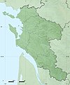
Paypay:Charente-Maritime department location map.svg

Size of this PNG preview of this SVG file: 499 × 600 nga mga pixel. Iba nga mga resolusyon: 200 × 240 nga mga pixel | 399 × 480 nga mga pixel | 639 × 768 nga mga pixel | 852 × 1,024 nga mga pixel | 1,704 × 2,048 nga mga pixel | 942 × 1,132 nga mga pixel.
Orihinal nga paypay (SVG nga fayl, ginbabanabanahan nga 942 × 1,132 nga mga pixel, kadako han fayl: 425 nga KB)
Kaagi han paypay
Pidlita an adlaw/oras para makit-an an fayl nga naggawas hito nga oras.
| Pitsa/Oras | Thumbnail | Mga dimensyon | Gumaramit | Komento | |
|---|---|---|---|---|---|
| waray pa kasasapawi | 02:43, 15 Oktubre 2008 |  | 942 × 1,132 (425 nga KB) | Sting | == Summary == {{Location|45|44|15|N|00|46|30|W|scale:1000000}} <br/> {{Information |Description={{en|Blank administrative map of the department of Charente-Maritime, France, for geo-location purpose, with distinct boundaries for |
Mga Sumpay
An mga nasunod nga mga pakli nasumpay hini nga paypay:
Global file usage
An masunod nga iba nga mga wiki in nagamit hini nga file:
- Paggamit ha als.wikipedia.org
- Paggamit ha ar.wikipedia.org
- Paggamit ha ceb.wikipedia.org
- Paggamit ha cs.wikipedia.org
- Paggamit ha cy.wikipedia.org
- Paggamit ha de.wikipedia.org
- Paggamit ha en.wikipedia.org
- Paggamit ha eo.wikipedia.org
- La Rochelle
- Saint-Trojan-les-Bains
- Île-d'Aix
- La Jarrie
- Esnandes
- Ŝablono:Informkesto ponto
- Ŝablono:Informkesto ponto/dokumentado
- Ponto de Oléron
- Rochefort (Charente-Maritime)
- Marennes (Charente-Maritime)
- Ŝablono:Situo sur mapo Francio Charente-Maritime
- Surgères
- Saint-Denis-d'Oléron
- Saint-Pierre-d'Oléron
- Saint-Georges-d'Oléron
- Hiers-Brouage
- Bourcefranc-le-Chapus
- Marsilly (Charente-Maritime)
- Lagord
- L'Houmeau
- Les Mathes
- Saint-Xandre
- La Brée-les-Bains
- Nieul-sur-Mer
- Puilboreau
- Charron (Charente-Maritime)
- Andilly (Charente-Maritime)
- Mornac-sur-Seudre
- Dompierre-sur-Mer
- Sainte-Soulle
Kitaa durudamo nga global usage hinin nga file.

