Paypay:Capri coastline.jpg

Kadako hin nga pahiuna nga pagawas: 800 × 600 nga mga pixel. Iba nga mga resolusyon: 320 × 240 nga mga pixel | 640 × 480 nga mga pixel | 1,024 × 768 nga mga pixel | 1,280 × 960 nga mga pixel | 2,560 × 1,920 nga mga pixel | 3,072 × 2,304 nga mga pixel.
Orihinal nga paypay (3,072 × 2,304 nga pixel, kadako han fayl: 3.51 nga MB, MIME nga tipo: image/jpeg)
Dalikyat nga pulong
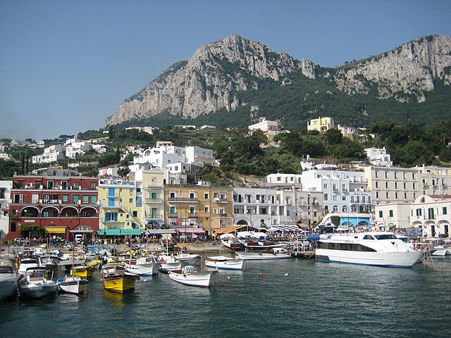
| Tigtulidong | Island of Capri from a boat offshore. |
| Petsa | |
| Ginkuhaan | Kalugaringon nga buhat |
| Awtor | Sean William |
| Camera location | | View this and other nearby images on: OpenStreetMap |
|---|
Palilisensya:
| This work has been released into the public domain by its author, I, Sean William. This applies worldwide. In some countries this may not be legally possible; if so: I, Sean William grants anyone the right to use this work for any purpose, without any conditions, unless such conditions are required by law. |
Kaagi han paypay
Pidlita an adlaw/oras para makit-an an fayl nga naggawas hito nga oras.
| Pitsa/Oras | Thumbnail | Mga dimensyon | Gumaramit | Komento | |
|---|---|---|---|---|---|
| waray pa kasasapawi | 01:39, 3 Agosto 2007 | | 3,072 × 2,304 (3.51 nga MB) | Sean William | {{Information |Description=Island of Capri from a boat offshore. |Source=self-made |Date=July 22, 2007 |Author= Sean William }} |
Mga Sumpay
An mga nasunod nga mga pakli nasumpay hini nga paypay:
Global file usage
An masunod nga iba nga mga wiki in nagamit hini nga file:
- Paggamit ha azb.wikipedia.org
- Paggamit ha ceb.wikipedia.org
- Paggamit ha en.wikipedia.org
- Paggamit ha en.wikivoyage.org
- Paggamit ha es.wikipedia.org
- Paggamit ha fa.wikipedia.org
- Paggamit ha fr.wikipedia.org
- Paggamit ha he.wikipedia.org
- Paggamit ha hr.wikipedia.org
- Paggamit ha hu.wikipedia.org
- Paggamit ha it.wikipedia.org
- Paggamit ha ja.wikipedia.org
- Paggamit ha ko.wikipedia.org
- Paggamit ha nl.wikipedia.org
- Paggamit ha no.wikipedia.org
- Paggamit ha pl.wikipedia.org
- Paggamit ha ro.wikipedia.org
- Paggamit ha ro.wikivoyage.org
- Paggamit ha sr.wikipedia.org
- Paggamit ha tl.wikipedia.org
- Paggamit ha tr.wikipedia.org
- Paggamit ha www.wikidata.org
- Paggamit ha zh.wikipedia.org