Paypay:CapeYorkPeninsulaMap 1 0.svg

Size of this PNG preview of this SVG file: 519 × 600 nga mga pixel. Iba nga mga resolusyon: 208 × 240 nga mga pixel | 415 × 480 nga mga pixel | 665 × 768 nga mga pixel | 886 × 1,024 nga mga pixel | 1,773 × 2,048 nga mga pixel | 2,131 × 2,462 nga mga pixel.
Orihinal nga paypay (SVG nga fayl, ginbabanabanahan nga 2,131 × 2,462 nga mga pixel, kadako han fayl: 123 nga KB)
Dalikyat nga pulong
| Tigtulidong |
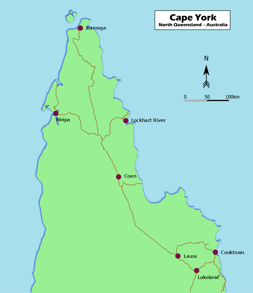
English: Map of Cape York Peninsula in Far North Queensland, Australia
Français : Carte de la péninsule de Cape York au nord de l'état du Queensland en Australie |
| Petsa | |
| Ginkuhaan | Kalugaringon nga buhat (also available on http://www.nactuslair.com/) |
| Awtor | Nactus' Lair |
| Other versions |
[]
|


Palilisensya:
| I, the copyright holder of this work, release this work into the public domain. This applies worldwide. In some countries this may not be legally possible; if so: I grant anyone the right to use this work for any purpose, without any conditions, unless such conditions are required by law. |
Kaagi han paypay
Pidlita an adlaw/oras para makit-an an fayl nga naggawas hito nga oras.
| Pitsa/Oras | Thumbnail | Mga dimensyon | Gumaramit | Komento | |
|---|---|---|---|---|---|
| waray pa kasasapawi | 03:59, 7 Hunyo 2010 | | 2,131 × 2,462 (123 nga KB) | Nactus' Lair | {{Information |Description={{en|1=Map of Cape York Peninsula in Far North Queensland, Australia}} {{fr|1=Carte de la péninsule de Cape York au nord de l'état du Queensland en Australie}} |Source={{own}} (also available on http://nactuslair.arnogou.com/) |
Mga Sumpay
An mga nasunod nga mga pakli nasumpay hini nga paypay:
Global file usage
An masunod nga iba nga mga wiki in nagamit hini nga file:
- Paggamit ha ar.wikipedia.org
- Paggamit ha az.wikipedia.org
- Paggamit ha eo.wikipedia.org
- Paggamit ha es.wikipedia.org
- Paggamit ha et.wikipedia.org
- Paggamit ha fi.wikipedia.org
- Paggamit ha fr.wikipedia.org
- Paggamit ha id.wikipedia.org
- Paggamit ha it.wikipedia.org
- Paggamit ha la.wikipedia.org
- Paggamit ha lt.wikipedia.org
- Paggamit ha nl.wikipedia.org
- Paggamit ha oc.wikipedia.org
- Paggamit ha pt.wikipedia.org
- Paggamit ha simple.wikipedia.org
- Paggamit ha sv.wikipedia.org
- Paggamit ha sw.wikipedia.org
- Paggamit ha uk.wikipedia.org
- Paggamit ha vi.wikipedia.org