Paypay:Belgium location map.svg

Size of this PNG preview of this SVG file: 689 × 599 nga mga pixel. Iba nga mga resolusyon: 276 × 240 nga mga pixel | 552 × 480 nga mga pixel | 883 × 768 nga mga pixel | 1,177 × 1,024 nga mga pixel | 2,355 × 2,048 nga mga pixel | 1,136 × 988 nga mga pixel.
Orihinal nga paypay (SVG nga fayl, ginbabanabanahan nga 1,136 × 988 nga mga pixel, kadako han fayl: 120 nga KB)
Dalikyat nga pulong
| Tigtulidong |
Deutsch: Positionskarte von Belgien
Quadratische Plattkarte, N-S-Streckung 157,218 %. Geographische Begrenzung der Karte:
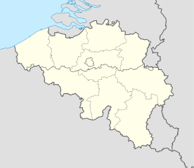
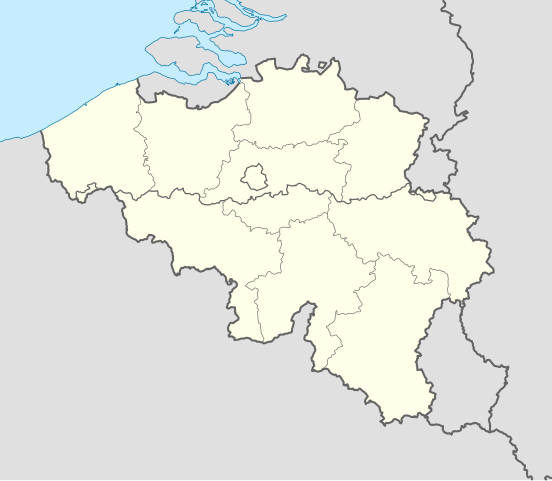
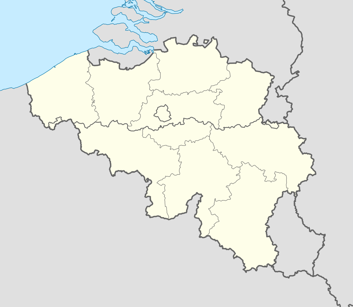
English: Location map of Belgium
Equirectangular projection, N/S stretching 157.218 %. Geographic limits of the map:
|
||
| Petsa | |||
| Ginkuhaan | Kalugaringon nga buhat (Original text: own work, using United States National Imagery and Mapping Agency data) | ||
| Awtor | NordNordWest | ||
| Other versions |
Derivative works of this file: |
||
| SVG genesis | This locator map was created with Adobe Illustrator by NordNordWest.
|


_location.svg)
_location.svg)
_location.svg)
_location.svg)
Palilisensya:
I, the copyright holder of this work, hereby publish it under the following licenses:

|
An permiso in ginhatag ha pagkopya, pagpakalat ngan/o pagliwat hinin nga dokumento ha ilarom han mga termino han GNU Free Documentation License, Version 1.2 o mas uruurhi nga version nga ginmantala han Free Software Foundation; nga may-ada waray Invariant Sections, waray Front-Cover Texts, ngan waray Back-Cover Texts. May-ada kopya hin lisensya nga ginlalakip ha seksyon nga may-ada pamagat nga GNU Free Documentation License. |
Ini nga file in nakalisensya ha ilarom han Creative Commons Attribution-Share Alike 3.0 Unported license.
- Talwas ka:
- para han pagpasaro – para han pagkopya, pagpakalat ngan pagpadangat han buhat
- para han pagremix – pag-adapt han buhat
- Ha ilarom an masunod nga mga kondisyon:
- attribution – Kinahanglanon mo tagan hin kaangayan nga credit, paghatag hin sumpay ngadto ha lisensya, ngan igbutang an imo ginbag-ohan nga binuhat. Puydi mo ini buhaton ha bisan ano nga resonable nga pamaagi, pero diri nimo pagawson nga an naghatag hin lisensya nag-eendorso ha imo o ha imo paggamit.
- share alike – Kun imo ginsagol-hin-otro, gin-iba, o gin-hingayad han buhat, ikaw in angay gud là magpakalat han imo gin-amot ha ilarom la han [http:creativecommons.org/share-your-work/licensing-considerations/compatible-licenses pareho o naangay nga lisensya] sugad han orihinal.
Puydi ka pumili hin lisenysa nga karuyag mo.
Kaagi han paypay
Pidlita an adlaw/oras para makit-an an fayl nga naggawas hito nga oras.
| Pitsa/Oras | Thumbnail | Mga dimensyon | Gumaramit | Komento | |
|---|---|---|---|---|---|
| waray pa kasasapawi | 18:26, 23 Septyembre 2010 | | 1,136 × 988 (120 nga KB) | NordNordWest | upd |
| 18:42, 25 Agosto 2008 |  | 1,136 × 945 (159 nga KB) | NordNordWest | size correction | |
| 19:01, 9 Hulyo 2008 |  | 379 × 315 (156 nga KB) | NordNordWest | {{Information |Description= {{de|Positionskarte von Belgien}} Quadratische Plattkarte, N-S-Streckung 150 %. Geographische Begrenzung der Karte: * N: 51.8° N * S: 49.2° N * W: 2.2° O * O: 6.9° O {{en|Location map of [[:en:Belgium|Belgiu |
Mga Sumpay
An mga nasunod nga mga pakli nasumpay hini nga paypay:
Global file usage
An masunod nga iba nga mga wiki in nagamit hini nga file:
- Paggamit ha ar.wikipedia.org
- Paggamit ha av.wikipedia.org
- Paggamit ha azb.wikipedia.org
- Paggamit ha ban.wikipedia.org
- Paggamit ha be.wikimedia.org
- Wiki Loves Monuments/website/Photo tour 28 September 2014/lb
- Wiki Loves Monuments/website/Photo tour 28 September 2014/fr
- Wiki Loves Monuments/website/Photo tour 28 September 2014/de
- Wiki Loves Monuments/website/Photo tour 28 September 2014/nl
- Wiki Loves Monuments/website/Photo tour 28 September 2014
- Uitnodiging voor de fototocht Wiki Takes... Leuven op 28 september 2014
- Invitation to the photo tour Wiki Takes... Leuven on 28 September 2014
- Invitation balade photographique Wiki Takes... Louvain, le 28 Septembre 2014
- Paggamit ha bn.wikipedia.org
- Paggamit ha bs.wikipedia.org
- Paggamit ha ca.wikipedia.org
- Paggamit ha ceb.wikipedia.org
Kitaa durudamo nga global usage hinin nga file.