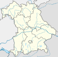
Paypay:Bavaria location map.svg

Size of this PNG preview of this SVG file: 608 × 600 nga mga pixel. Iba nga mga resolusyon: 243 × 240 nga mga pixel | 487 × 480 nga mga pixel | 779 × 768 nga mga pixel | 1,038 × 1,024 nga mga pixel | 2,077 × 2,048 nga mga pixel | 867 × 855 nga mga pixel.
Orihinal nga paypay (SVG nga fayl, ginbabanabanahan nga 867 × 855 nga mga pixel, kadako han fayl: 738 nga KB)
Kaagi han paypay
Pidlita an adlaw/oras para makit-an an fayl nga naggawas hito nga oras.
| Pitsa/Oras | Thumbnail | Mga dimensyon | Gumaramit | Komento | |
|---|---|---|---|---|---|
| waray pa kasasapawi | 17:22, 19 Nobyembre 2009 |  | 867 × 855 (738 nga KB) | Alexrk2 | fixed boundaries, rivers; adjusted map projection; colors for internal divisions |
| 20:01, 28 Marso 2009 |  | 867 × 855 (1.05 nga MB) | TUBS | #corrected 4 mistakes (lake margins (pasted to foreground), RegBez and counties around TIR (splited area in two counties and corrected RegBez border), County of Munich (merged), Merged an (to me right know unknown) county north of Nuremberg. #moved all gr | |
| 09:32, 28 Enero 2009 |  | 867 × 855 (1.45 nga MB) | TUBS | {{Information |Description= |Source= |Date= |Author= |Permission= |other_versions= }} | |
| 00:20, 28 Enero 2009 |  | 867 × 855 (1.45 nga MB) | TUBS | {{Information |Description= |Source= |Date= |Author= |Permission= |other_versions= }} | |
| 00:11, 27 Enero 2009 |  | 867 × 855 (1.46 nga MB) | TUBS | {{Information |Description= |Source= |Date= |Author= |Permission= |other_versions= }} | |
| 23:20, 26 Enero 2009 |  | 867 × 855 (1.5 nga MB) | TUBS | {{Information |Description= |Source= |Date= |Author= |Permission= |other_versions= }} | |
| 11:38, 26 Enero 2009 |  | 867 × 855 (1.51 nga MB) | TUBS | == Summary == {{Information |Description= {{de|Positionskarte Hessen, Deutschland. Geographische Begrenzung der Karte:}} {{en|Location map Bavaria, Germany. Geographic limits of the map:}} * N: 50.6303000° N * S: 47.26618 | |
| 11:24, 26 Enero 2009 |  | 867 × 855 (1.52 nga MB) | TUBS | == Summary == {{Information |Description= {{de|Positionskarte Hessen, Deutschland. Geographische Begrenzung der Karte:}} {{en|Location map Bavaria, Germany. Geographic limits of the map:}} * N: 50.6303000° N * S: 47.26618 |
Mga Sumpay
An mga nasunod nga mga pakli nasumpay hini nga paypay:
Global file usage
An masunod nga iba nga mga wiki in nagamit hini nga file:
- Paggamit ha af.wikipedia.org
- Paggamit ha als.wikipedia.org
- Paggamit ha ar.wikipedia.org
- Paggamit ha ast.wikipedia.org
- Paggamit ha azb.wikipedia.org
Kitaa durudamo nga global usage hinin nga file.

