Paypay:Australia Victoria Strathbogie Shire location map.svg

Size of this PNG preview of this SVG file: 533 × 388 nga mga pixel. Iba nga mga resolusyon: 320 × 233 nga mga pixel | 640 × 466 nga mga pixel | 1,024 × 745 nga mga pixel | 1,280 × 932 nga mga pixel | 2,560 × 1,864 nga mga pixel.
Orihinal nga paypay (SVG nga fayl, ginbabanabanahan nga 533 × 388 nga mga pixel, kadako han fayl: 536 nga KB)
| Tigtulidong |
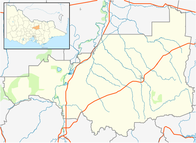
English: Blank map of w:Strathbogie Shire, Victoria, Australia, with the following information shown:
Geographic limits:
|
||
| Ginkuhaan | Kalugaringon nga buhat + VicMap Lite | ||
| Awtor | Cassowary |

Kaagi han paypay
Pidlita an adlaw/oras para makit-an an fayl nga naggawas hito nga oras.
| Pitsa/Oras | Thumbnail | Mga dimensyon | Gumaramit | Komento | |
|---|---|---|---|---|---|
| waray pa kasasapawi | 15:24, 18 Pebrero 2011 | | 533 × 388 (536 nga KB) | Cassowary | {{Information |Description ={{en|1=Blank map of w:Strathbogie Shire, Victoria, Australia, with the following information shown: * LGA boundaries * Coastline, lakes and rivers * Highways and freeways * Urban areas * Parks Geographic limits: * North |
Mga Sumpay
An mga nasunod nga mga pakli nasumpay hini nga paypay:
Global file usage
An masunod nga iba nga mga wiki in nagamit hini nga file:
- Paggamit ha ar.wikipedia.org
- Paggamit ha ceb.wikipedia.org
- Paggamit ha en.wikipedia.org
- Shire of Strathbogie
- Euroa
- Violet Town
- Strathbogie, Victoria
- Avenel, Victoria
- Upotipotpon, Victoria
- Baddaginnie, Victoria
- Nagambie
- Template:Towns in Strathbogie Shire
- Longwood, Victoria
- Ruffy, Victoria
- Mangalore, Victoria
- Module:Location map/data/Australia Victoria Shire of Strathbogie/doc
- User:Diggers2004/sandbox
- Locksley, Victoria
- Mount Teneriffe
- Miepoll
- Whroo
- Graytown, Victoria
- Moorilim
- Kirwans Bridge, Victoria
- Mitchellstown
- Wahring, Victoria
- Module:Location map/data/Australia Victoria Shire of Strathbogie
- Tabilk
- User:Viatori/sandbox
- User:ThylacineHunter/LGA
- Paggamit ha fa.wikipedia.org
- Paggamit ha kn.wikipedia.org
- Paggamit ha simple.wikipedia.org
- Paggamit ha si.wikipedia.org
- Paggamit ha tr.wikipedia.org
- Paggamit ha uz.wikipedia.org