Paypay:Australia Victoria Moira Shire location map.svg

Size of this PNG preview of this SVG file: 535 × 321 nga mga pixel. Iba nga mga resolusyon: 320 × 192 nga mga pixel | 640 × 384 nga mga pixel | 1,024 × 614 nga mga pixel | 1,280 × 768 nga mga pixel | 2,560 × 1,536 nga mga pixel.
Orihinal nga paypay (SVG nga fayl, ginbabanabanahan nga 535 × 321 nga mga pixel, kadako han fayl: 540 nga KB)
| Tigtulidong |
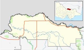
English: Blank map of w:Moira Shire, Victoria, Australia, with the following information shown:
Geographic limits:
|
||
| Ginkuhaan | Kalugaringon nga buhat + VicMap Lite | ||
| Awtor | Cassowary |

Kaagi han paypay
Pidlita an adlaw/oras para makit-an an fayl nga naggawas hito nga oras.
| Pitsa/Oras | Thumbnail | Mga dimensyon | Gumaramit | Komento | |
|---|---|---|---|---|---|
| waray pa kasasapawi | 17:56, 18 Pebrero 2011 | | 535 × 321 (540 nga KB) | Cassowary | {{Information |Description ={{en|1=Blank map of w:Moria Shire, Victoria, Australia, with the following information shown: * LGA boundaries * Coastline, lakes and rivers * Highways and freeways * Urban areas * Parks Geographic limits: * North: 35.6 |
Mga Sumpay
An mga nasunod nga mga pakli nasumpay hini nga paypay:
Global file usage
An masunod nga iba nga mga wiki in nagamit hini nga file:
- Paggamit ha ar.wikipedia.org
- Paggamit ha ceb.wikipedia.org
- Paggamit ha en.wikipedia.org
- Shire of Moira
- Barmah
- Strathmerton
- Cobram
- Yarrawonga
- Numurkah
- Nathalia, Victoria
- Katamatite
- Katunga
- Tungamah
- Wunghnu
- Template:Towns in Moira Shire
- Bundalong, Victoria
- Cobram East
- Yarroweyah
- Picola
- Waaia
- St James, Victoria
- Bearii
- Koonoomoo
- Peechelba
- Invergordon, Victoria
- Telford, Victoria
- Module:Location map/data/Australia Victoria Shire of Moira/doc
- Youanmite
- Almonds, Victoria
- Wilby, Victoria
- Lower Moira
- Yalca
- Picola West
- Kotupna
- Yielima
- Kaarimba
- Mundoona
- Ulupna
- Mywee
- Drumanure
- Marungi
- Naring
- Muckatah
- Yabba North
- Yabba South
- Katamatite East
- Waggarandall
- Boosey, Victoria
- Youarang
- Yundool
- Burramine
Kitaa durudamo nga global usage hinin nga file.