Paypay:Australia Victoria Indigo Shire location map.svg

Size of this PNG preview of this SVG file: 535 × 363 nga mga pixel. Iba nga mga resolusyon: 320 × 217 nga mga pixel | 640 × 434 nga mga pixel | 1,024 × 695 nga mga pixel | 1,280 × 868 nga mga pixel | 2,560 × 1,737 nga mga pixel.
Orihinal nga paypay (SVG nga fayl, ginbabanabanahan nga 535 × 363 nga mga pixel, kadako han fayl: 575 nga KB)
| Tigtulidong |
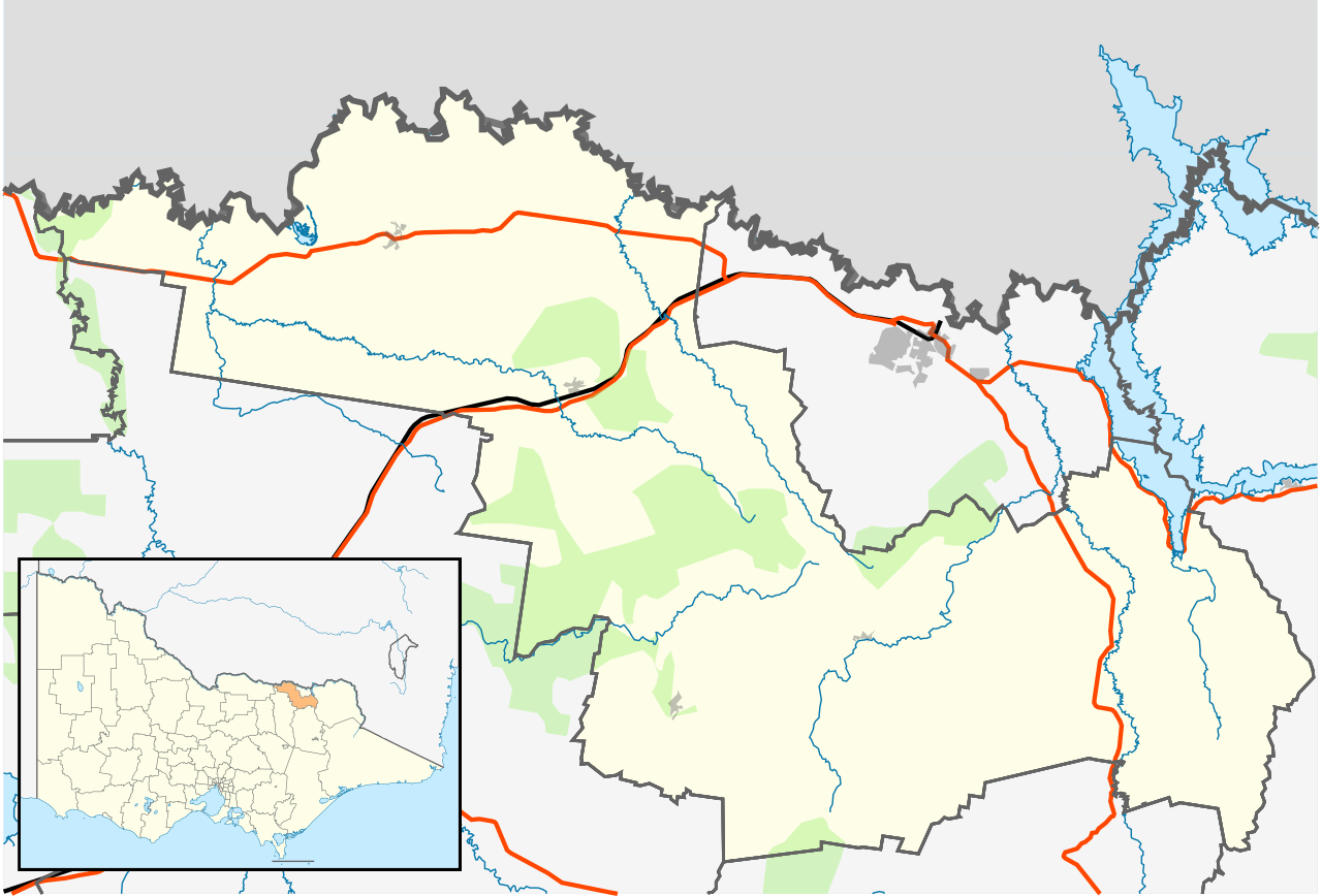
English: Blank map of w:Indigo Shire, Victoria, Australia, with the following information shown:
Geographic limits:
|
||
| Ginkuhaan | Kalugaringon nga buhat | ||
| Awtor | Cassowary |

Kaagi han paypay
Pidlita an adlaw/oras para makit-an an fayl nga naggawas hito nga oras.
| Pitsa/Oras | Thumbnail | Mga dimensyon | Gumaramit | Komento | |
|---|---|---|---|---|---|
| waray pa kasasapawi | 16:02, 17 Pebrero 2011 | | 535 × 363 (575 nga KB) | Cassowary | {{Information |Description ={{en|1=Blank map of w:Indigo Shire, Victoria, Australia, with the following information shown: * LGA boundaries * Coastline, lakes and rivers * Roads and railways * Urban areas * Parks Geographic limits: * North: 35.9S |
Mga Sumpay
An mga nasunod nga mga pakli nasumpay hini nga paypay:
Global file usage
An masunod nga iba nga mga wiki in nagamit hini nga file:
- Paggamit ha ar.wikipedia.org
- Paggamit ha ceb.wikipedia.org
- Paggamit ha en.wikipedia.org
- Rutherglen, Victoria
- Shire of Indigo
- Yackandandah
- Beechworth
- Tangambalanga
- Allans Flat, Victoria
- Baarmutha, Victoria
- Chiltern, Victoria
- Stanley, Victoria
- Wahgunyah
- Barnawartha, Victoria
- Template:Towns in Indigo Shire
- Indigo Valley, Victoria
- Mudgegonga
- Kergunyah
- Module:Location map/data/Australia Victoria Shire of Indigo/doc
- Staghorn Flat
- Lake Moodemere
- Huon, Victoria
- Gooramadda
- Gundowring
- Kiewa
- Wooragee
- Module:Location map/data/Australia Victoria Shire of Indigo
- User:Viatori/sandbox
- User:ThylacineHunter/LGA
- Paggamit ha fa.wikipedia.org
- Paggamit ha id.wikipedia.org
- Paggamit ha kn.wikipedia.org
- Paggamit ha simple.wikipedia.org
- Paggamit ha si.wikipedia.org
- Paggamit ha tr.wikipedia.org
- Paggamit ha uz.wikipedia.org