Paypay:Andorra location map.svg

Size of this PNG preview of this SVG file: 683 × 599 nga mga pixel. Iba nga mga resolusyon: 274 × 240 nga mga pixel | 547 × 480 nga mga pixel | 875 × 768 nga mga pixel | 1,167 × 1,024 nga mga pixel | 2,333 × 2,048 nga mga pixel | 1,161 × 1,019 nga mga pixel.
Orihinal nga paypay (SVG nga fayl, ginbabanabanahan nga 1,161 × 1,019 nga mga pixel, kadako han fayl: 149 nga KB)
Dalikyat nga pulong
| Tigtulidong |
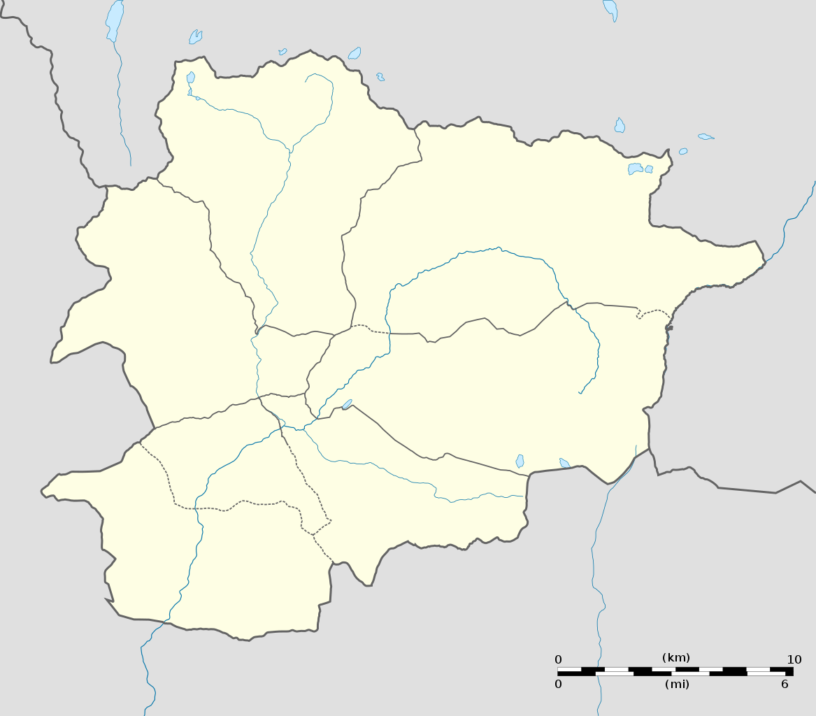
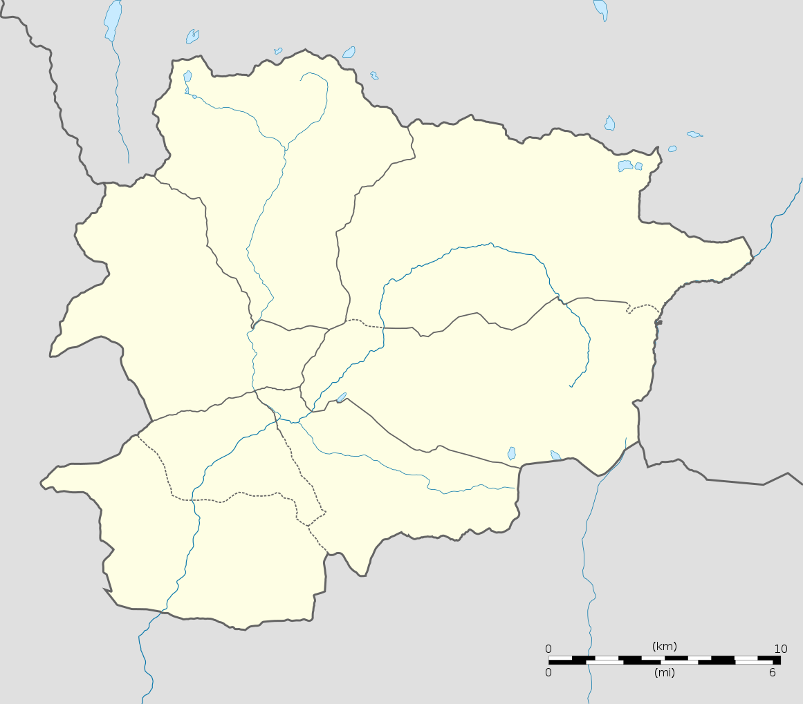
English: Blank administrative map of Andorra with parishes boundaries for geo-location purpose.
Note: Dotted lines are boundaries estimated from very small scale reference maps. Français : Carte administrative vierge de l'Andorre avec limites des paroisses destinée à la géolocalisation. Note : les lignes pointillées sont des limites estimées à partir de cartes de référence à très petite échelle. Equirectangular projection, WGS84 datum
Topographic scale: 1:372,000 (precision: 93 m)
|
||
| Petsa | |||
| Ginkuhaan |
Kalugaringon nga buhat (Original text: Own work) |
||
| Awtor | Eric Gaba (Sting - fr:Sting) | ||
| Pagtugot (Gin-uutro paggamit inin nga file) |
|
||
| Other versions |
|
||
| SVG genesis |

| Camera location | | View this and other nearby images on: OpenStreetMap |
|---|
Palilisensya:
I, the copyright holder of this work, hereby publish it under the following licenses:
Ini nga file in nakalisensya ha ilarom han Creative Commons Attribution-Share Alike 3.0 Unported license.
- Talwas ka:
- para han pagpasaro – para han pagkopya, pagpakalat ngan pagpadangat han buhat
- para han pagremix – pag-adapt han buhat
- Ha ilarom an masunod nga mga kondisyon:
- attribution – Kinahanglanon mo tagan hin kaangayan nga credit, paghatag hin sumpay ngadto ha lisensya, ngan igbutang an imo ginbag-ohan nga binuhat. Puydi mo ini buhaton ha bisan ano nga resonable nga pamaagi, pero diri nimo pagawson nga an naghatag hin lisensya nag-eendorso ha imo o ha imo paggamit.
- share alike – Kun imo ginsagol-hin-otro, gin-iba, o gin-hingayad han buhat, ikaw in angay gud là magpakalat han imo gin-amot ha ilarom la han [http:creativecommons.org/share-your-work/licensing-considerations/compatible-licenses pareho o naangay nga lisensya] sugad han orihinal.

|
An permiso in ginhatag ha pagkopya, pagpakalat ngan/o pagliwat hinin nga dokumento ha ilarom han mga termino han GNU Free Documentation License, Version 1.2 o mas uruurhi nga version nga ginmantala han Free Software Foundation; nga may-ada waray Invariant Sections, waray Front-Cover Texts, ngan waray Back-Cover Texts. May-ada kopya hin lisensya nga ginlalakip ha seksyon nga may-ada pamagat nga GNU Free Documentation License. |
Puydi ka pumili hin lisenysa nga karuyag mo.
Kaagi han paypay
Pidlita an adlaw/oras para makit-an an fayl nga naggawas hito nga oras.
| Pitsa/Oras | Thumbnail | Mga dimensyon | Gumaramit | Komento | |
|---|---|---|---|---|---|
| waray pa kasasapawi | 20:06, 27 Disyembre 2010 | | 1,161 × 1,019 (149 nga KB) | Sting | Added parishes boundaries (some of them estimated) |
| 20:02, 17 Disyembre 2008 |  | 1,161 × 1,019 (142 nga KB) | Sting | Deleted temporary parishes boundaries | |
| 20:01, 17 Disyembre 2008 |  | 1,161 × 1,019 (171 nga KB) | Sting | Corrections on international boundaries; added (incomplete but reliable) parishes boundaries | |
| 20:24, 16 Disyembre 2008 |  | 1,161 × 1,019 (116 nga KB) | Sting | == Summary == {{Location|42|32|15|N|01|36|00|E|scale:200000}} <br/> {{Information |Description={{en|Blank administrative map of Andorra for geo-location purpose.}} {{fr|Carte administrative vierge de l'Andorre destinée à |
Mga Sumpay
An mga nasunod nga mga pakli nasumpay hini nga paypay:
Global file usage
An masunod nga iba nga mga wiki in nagamit hini nga file:
- Paggamit ha af.wikipedia.org
- Paggamit ha an.wikipedia.org
- Paggamit ha ar.wikipedia.org
- Paggamit ha ast.wikipedia.org
- Les Escaldes
- Puertu d'Envalira
- Andorra la Vieya
- Soldeu
- Llagos de Tristaina
- El Tarter
- Incles
- Arans
- Comapedrosa
- Módulu:Mapa de llocalización/datos/Andorra
- Módulu:Mapa de llocalización/datos/Andorra/usu
- Helipuertu d'Andorra la Vieya
- Casa de la Vall
- Ilesia de San Esteban (Andorra)
- Pont de la Margineda
- Ilesia de Sant Vicenç d'Enclar
- Ilesia de Santa Coloma (Andorra)
- Hospital Nostra Senyora de Meritxell
- Paggamit ha av.wikipedia.org
- Paggamit ha az.wikipedia.org
- Paggamit ha ba.wikipedia.org
- Paggamit ha be-tarask.wikipedia.org
- Paggamit ha be.wikipedia.org
- Paggamit ha bg.wikipedia.org
- Paggamit ha bn.wikipedia.org
- Paggamit ha bs.wikipedia.org
Kitaa durudamo nga global usage hinin nga file.