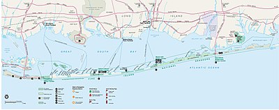
Batakan:Location map USA New York Fire Island
| name | Fire Island | |||
|---|---|---|---|---|
| border coordinates | ||||
| 40.84 | ||||
| -73.33 | ←↕→ | -72.77 | ||
| 40.58 | ||||
| map center | 40°43′N 73°03′W / 40.71°N 73.05°W | |||
| x | 160.91295*({{{3}}} + 73.348669) + 47.97453*({{{2}}} - 40.740397) | |||
| y | 93.38964*({{{3}}} + 73.348669) - 536.58519*({{{2}}} - 40.740397) | |||
| image | Fire-island-map.jpg
| |||

| ||||