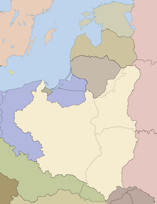
Batakan:Location map Poland 1939
| name | Poland | |||
|---|---|---|---|---|
| border coordinates | ||||
| 59.583 | ||||
| 13.56 | ←↕→ | 30.267 | ||
| 47.567 | ||||
| map center | 53°34′30″N 21°54′49″E / 53.575°N 21.9135°E | |||
| image | Rzeczpospolita 1937 noname noriver.png
| |||

| ||||
| name | Poland | |||
|---|---|---|---|---|
| border coordinates | ||||
| 59.583 | ||||
| 13.56 | ←↕→ | 30.267 | ||
| 47.567 | ||||
| map center | 53°34′30″N 21°54′49″E / 53.575°N 21.9135°E / 53.575; 21.9135 | |||
| image | Rzeczpospolita 1937 noname noriver.png
| |||

| ||||