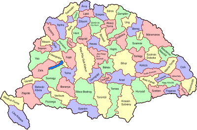
Batakan:Location map Kingdom of Hungary
| name | Kingdom of Hungary | |||
|---|---|---|---|---|
| border coordinates | ||||
| 49.63 | ||||
| 14.00 | ←↕→ | 28.17 | ||
| 44.13 | ||||
| map center | 46°52′48″N 21°05′06″E / 46.88°N 21.085°E | |||
| image | Kingdom of Hungary counties-2.svg
| |||

| ||||
The coordinates are measured off a quite good section of what appears to be a Mercator projection at File:Hungary-ethnic_groups.jpg. While this is not an equirectangular projection as expected by {{Location map}}, the distortion at these latitudes is probably small enough not to matter at this small scale.
| Editors can experiment in this template's sandbox (create) and testcases (create) pages. Subpages of this template. |