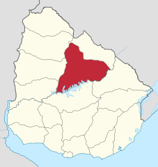
Paypay:Tacuarembo in Uruguay.svg

Size of this PNG preview of this SVG file: 568 × 600 nga mga pixel. Iba nga mga resolusyon: 227 × 240 nga mga pixel | 455 × 480 nga mga pixel | 727 × 768 nga mga pixel | 970 × 1,024 nga mga pixel | 1,939 × 2,048 nga mga pixel | 1,000 × 1,056 nga mga pixel.
Orihinal nga paypay (SVG nga fayl, ginbabanabanahan nga 1,000 × 1,056 nga mga pixel, kadako han fayl: 184 nga KB)
Dalikyat nga pulong
.svg)
.svg)
.svg)
.svg)
.svg)
.svg)
.svg)

-en.svg)

.svg)
.svg)
.svg)

_(US48).svg)
_(small_islands_magnified)_(-mini_map_-rivers).svg)
.svg)
_(extra_close)_(US48).svg)
.svg)
_(zoom).svg)

.svg)


_(UNMIK).svg)
.svg)
_(disputed_hatched).svg)
_(claimed_and_disputed_hatched).svg)
.svg)
.svg)
_(%2Ball_claims_hatched).svg)

.svg)
_(shade).svg)
_(shade)_(special_marker).svg)
_(-mini_map).svg)
_(-mini_map).svg)
_(-mini_map).svg)


.svg)

.svg)
Palilisensya:
I, the copyright holder of this work, hereby publish it under the following license:
Ini nga file in nakalisensya ha ilarom han Creative Commons Attribution-Share Alike 3.0 Unported license.
- Talwas ka:
- para han pagpasaro – para han pagkopya, pagpakalat ngan pagpadangat han buhat
- para han pagremix – pag-adapt han buhat
- Ha ilarom an masunod nga mga kondisyon:
- attribution – Kinahanglanon mo tagan hin kaangayan nga credit, paghatag hin sumpay ngadto ha lisensya, ngan igbutang an imo ginbag-ohan nga binuhat. Puydi mo ini buhaton ha bisan ano nga resonable nga pamaagi, pero diri nimo pagawson nga an naghatag hin lisensya nag-eendorso ha imo o ha imo paggamit.
- share alike – Kun imo ginsagol-hin-otro, gin-iba, o gin-hingayad han buhat, ikaw in angay gud là magpakalat han imo gin-amot ha ilarom la han [http:creativecommons.org/share-your-work/licensing-considerations/compatible-licenses pareho o naangay nga lisensya] sugad han orihinal.

|
I'd greatly appreciate, that you attribute this media file to Wikimedia Commons, if used outside Wikipedia or Commons. For use in publications such as books, newspapers, blogs, websites, please insert here the following line:
|
Kaagi han paypay
Pidlita an adlaw/oras para makit-an an fayl nga naggawas hito nga oras.
| Pitsa/Oras | Thumbnail | Mga dimensyon | Gumaramit | Komento | |
|---|---|---|---|---|---|
| waray pa kasasapawi | 12:51, 16 Nobyembre 2011 | | 1,000 × 1,056 (184 nga KB) | TUBS |
Mga Sumpay
An mga nasunod nga mga pakli nasumpay hini nga paypay:
Global file usage
An masunod nga iba nga mga wiki in nagamit hini nga file:
- Paggamit ha ar.wikipedia.org
- Paggamit ha ast.wikipedia.org
- Paggamit ha be-tarask.wikipedia.org
- Paggamit ha bg.wikipedia.org
- Paggamit ha ca.wikipedia.org
- Paggamit ha ceb.wikipedia.org
- Paggamit ha da.wikipedia.org
- Paggamit ha de.wikipedia.org
- Paggamit ha en.wikipedia.org
- Tacuarembó
- Tacuarembó Department
- Paso de los Toros
- Cuchilla de Caraguatá
- Cruz de los Caminos, Tacuarembó
- Category:Tacuarembó Department
- Cerro Batoví
- Chamberlain, Uruguay
- Template:Tacuarembó Department
- Achar, Uruguay
- Tambores
- Las Toscas, Tacuarembó
- Ansina
- Curtina
- Paso Bonilla
- Paso del Cerro
- San Gregorio de Polanco
- Battle of Tacuarembó
- Template:Tacuarembó-geo-stub
- User:GerardM/Provinces of Uruguay
- Municipality of San Gregorio de Polanco
- Paggamit ha eo.wikipedia.org
- Paggamit ha es.wikipedia.org
Kitaa durudamo nga global usage hinin nga file.