Paypay:Philippines location map.svg

Size of this PNG preview of this SVG file: 454 × 599 nga mga pixel. Iba nga mga resolusyon: 182 × 240 nga mga pixel | 364 × 480 nga mga pixel | 582 × 768 nga mga pixel | 776 × 1,024 nga mga pixel | 1,552 × 2,048 nga mga pixel | 1,871 × 2,468 nga mga pixel.
Orihinal nga paypay (SVG nga fayl, ginbabanabanahan nga 1,871 × 2,468 nga mga pixel, kadako han fayl: 2.18 nga MB)
Dalikyat nga pulong
| Tigtulidong |
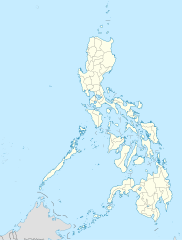
Deutsch: Positionskarte der Philippinen
Quadratische Plattkarte, N-S-Streckung 103 %. Geographische Begrenzung der Karte:
English: Location map of the Philippines
Equirectangular projection, N/S stretching 103 %. Geographic limits of the map:
|
| Petsa | |
| Ginkuhaan |
own work, using
|
| Awtor | NordNordWest |
| Other versions |
|


|
This map has been made or improved in the German Kartenwerkstatt (Map Lab). You can propose maps to improve as well.
|
Palilisensya:
I, the copyright holder of this work, hereby publish it under the following licenses:

|
An permiso in ginhatag ha pagkopya, pagpakalat ngan/o pagliwat hinin nga dokumento ha ilarom han mga termino han GNU Free Documentation License, Version 1.2 o mas uruurhi nga version nga ginmantala han Free Software Foundation; nga may-ada waray Invariant Sections, waray Front-Cover Texts, ngan waray Back-Cover Texts. May-ada kopya hin lisensya nga ginlalakip ha seksyon nga may-ada pamagat nga GNU Free Documentation License. |
This file is licensed under the Creative Commons Attribution 3.0 Unported license.
- Talwas ka:
- para han pagpasaro – para han pagkopya, pagpakalat ngan pagpadangat han buhat
- para han pagremix – pag-adapt han buhat
- Ha ilarom an masunod nga mga kondisyon:
- attribution – Kinahanglanon mo tagan hin kaangayan nga credit, paghatag hin sumpay ngadto ha lisensya, ngan igbutang an imo ginbag-ohan nga binuhat. Puydi mo ini buhaton ha bisan ano nga resonable nga pamaagi, pero diri nimo pagawson nga an naghatag hin lisensya nag-eendorso ha imo o ha imo paggamit.
Puydi ka pumili hin lisenysa nga karuyag mo.
Kaagi han paypay
Pidlita an adlaw/oras para makit-an an fayl nga naggawas hito nga oras.
| Pitsa/Oras | Thumbnail | Mga dimensyon | Gumaramit | Komento | |
|---|---|---|---|---|---|
| waray pa kasasapawi | 22:17, 25 Marso 2016 | | 1,871 × 2,468 (2.18 nga MB) | Man77 | upd NIR, Davao |
| 11:46, 14 Oktubre 2013 |  | 1,871 × 2,468 (2.2 nga MB) | Hariboneagle927 | fix | |
| 11:07, 14 Oktubre 2013 |  | 1,871 × 2,468 (2.15 nga MB) | Hariboneagle927 | fix. Cagayan | |
| 10:58, 14 Oktubre 2013 |  | 1,871 × 2,468 (2.15 nga MB) | Hariboneagle927 | Made some update and corrected some minor errors. | |
| 07:22, 9 Oktubre 2013 |  | 1,871 × 2,468 (2.14 nga MB) | Hellerick | Regrouped for easier recoloring. | |
| 06:13, 7 Agosto 2013 |  | 1,871 × 2,468 (1.07 nga MB) | Hellerick | Regional division replaced with provincial division. | |
| 19:09, 5 Hulyo 2009 |  | 1,871 × 2,468 (1,009 nga KB) | NordNordWest | ||
| 21:04, 25 Mayo 2009 |  | 1,687 × 2,469 (999 nga KB) | NordNordWest | {{Information |Description= {{de|Positionskarte der Philippinen}} Quadratische Plattkarte, N-S-Streckung 103 %. Geographische Begrenzung der Karte: * N: 21.2° N * S: 4.3° N * W: 115.4° O * O: 127.3° O {{en|Location map of the [[:en |
Mga Sumpay
An mga nasunod nga mga pakli nasumpay hini nga paypay:
Global file usage
An masunod nga iba nga mga wiki in nagamit hini nga file:
- Paggamit ha af.wikipedia.org
- Paggamit ha als.wikipedia.org
- Paggamit ha an.wikipedia.org
- Paggamit ha az.wikipedia.org
- Paggamit ha be-tarask.wikipedia.org
- Paggamit ha be.wikipedia.org
- Paggamit ha bn.wikipedia.org
- Paggamit ha ce.wikipedia.org
- Paggamit ha ckb.wikipedia.org
- Paggamit ha crh.wikipedia.org
- Paggamit ha cs.wikipedia.org
Kitaa durudamo nga global usage hinin nga file.