Paypay:Map of Texas highlighting Angelina County.svg

Size of this PNG preview of this SVG file: 631 × 600 nga mga pixel. Iba nga mga resolusyon: 253 × 240 nga mga pixel | 505 × 480 nga mga pixel | 808 × 768 nga mga pixel | 1,077 × 1,024 nga mga pixel | 2,155 × 2,048 nga mga pixel | 12,473 × 11,855 nga mga pixel.
Orihinal nga paypay (SVG nga fayl, ginbabanabanahan nga 12,473 × 11,855 nga mga pixel, kadako han fayl: 304 nga KB)
Dalikyat nga pulong
| Tigtulidong |
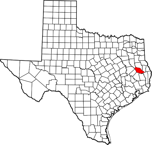
English: This is a locator map showing Angelina County in Texas. For more information, see Commons:United States county locator maps. |
| Petsa | |
| Ginkuhaan |
Kalugaringon nga buhat: English: The maps use data from nationalatlas.gov, specifically countyp020.tar.gz on the Raw Data Download page. The maps also use state outline data from statesp020.tar.gz. The Florida maps use hydrogm020.tar.gz to display Lake Okeechobee. |
| Awtor | David Benbennick |
Palilisensya:
| I, the copyright holder of this work, release this work into the public domain. This applies worldwide. In some countries this may not be legally possible; if so: I grant anyone the right to use this work for any purpose, without any conditions, unless such conditions are required by law. |
Kaagi han paypay
Pidlita an adlaw/oras para makit-an an fayl nga naggawas hito nga oras.
| Pitsa/Oras | Thumbnail | Mga dimensyon | Gumaramit | Komento | |
|---|---|---|---|---|---|
| waray pa kasasapawi | 16:37, 12 Pebrero 2006 | | 12,473 × 11,855 (304 nga KB) | David Benbennick | {{subst:User:Dbenbenn/clm|county=Angelina County|state=Texas|type=county}} |
Mga Sumpay
An mga nasunod nga mga pakli nasumpay hini nga paypay:
Global file usage
An masunod nga iba nga mga wiki in nagamit hini nga file:
- Paggamit ha ar.wikipedia.org
- Paggamit ha az.wikipedia.org
- Paggamit ha be.wikipedia.org
- Paggamit ha bg.wikipedia.org
- Paggamit ha bpy.wikipedia.org
- Paggamit ha cdo.wikipedia.org
- Paggamit ha ceb.wikipedia.org
- Paggamit ha cs.wikipedia.org
- Paggamit ha cy.wikipedia.org
- Paggamit ha da.wikipedia.org
- Paggamit ha de.wikipedia.org
- Paggamit ha en.wikipedia.org
- List of counties in Texas
- Angelina County, Texas
- Burke, Texas
- Diboll, Texas
- Hudson, Texas
- Huntington, Texas
- Lufkin, Texas
- Zavalla, Texas
- Pollok, Texas
- Homer, Texas
- Herty, Texas
- Template:Angelina County, Texas
- Category:Wikipedia requested photographs in Angelina County, Texas
- User:Nyttend/County templates/TX/1
- Template:AngelinaCountyTX-geo-stub
- National Register of Historic Places listings in Angelina County, Texas
- Category:Populated places in Angelina County, Texas
- Redland, Texas
- Manning, Texas
- List of census-designated places in Texas
- Bald Hill, Texas
- Central, Angelina County, Texas
- Clawson, Texas
- Moffett, Texas
- Redtown, Angelina County, Texas
- Alco, Texas
- Beulah, Angelina County, Texas
- Boynton, Texas
- Concord, Angelina County, Texas
- Dunagan, Texas
- Durant, Texas
- Ewing, Angelina County, Texas
- Granville, Texas
- Monterey, Angelina County, Texas
- Nancy, Texas
Kitaa durudamo nga global usage hinin nga file.