Paypay:Krapina-Zagorje County OpenStreetMap.svg

Size of this PNG preview of this SVG file: 800 × 537 nga mga pixel. Iba nga mga resolusyon: 320 × 215 nga mga pixel | 640 × 429 nga mga pixel | 1,024 × 687 nga mga pixel | 1,280 × 859 nga mga pixel | 2,560 × 1,718 nga mga pixel | 3,030 × 2,033 nga mga pixel.
Orihinal nga paypay (SVG nga fayl, ginbabanabanahan nga 3,030 × 2,033 nga mga pixel, kadako han fayl: 61.5 nga MB)
| Description |
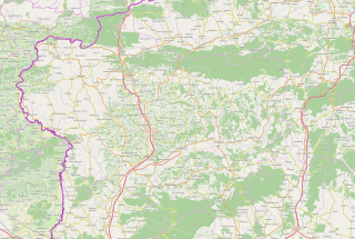
This map of Krapinsko-zagorska županija was created from OpenStreetMap project data, collected by the community. This map may be incomplete, and may contain errors. Don't rely solely on it for navigation. |
| Petsa | (see file history) |
| Ginkuhaan | openstreetmap.org |
| Creator |
OpenStreetMap contributors |
| Pagtugot (Gin-uutro paggamit inin nga file) |
OpenStreetMap data and maps are licensed under the Creative Commons Attribution-ShareAlike 2.0 license (CC-BY-SA 2.0). This file is licensed under the Creative Commons Attribution-Share Alike 2.0 Generic license.
|
| Georeferencing | If inappropriate please set warp_status = skip to hide. |
Kaagi han paypay
Pidlita an adlaw/oras para makit-an an fayl nga naggawas hito nga oras.
| Pitsa/Oras | Thumbnail | Mga dimensyon | Gumaramit | Komento | |
|---|---|---|---|---|---|
| waray pa kasasapawi | 15:55, 18 Abril 2017 | | 3,030 × 2,033 (61.5 nga MB) | Vedran V | An updated version of map |
| 07:19, 23 Enero 2015 |  | 2,820 × 1,899 (19.35 nga MB) | Vedran V | Updated version of map | |
| 13:50, 7 Marso 2010 |  | 831 × 676 (1.48 nga MB) | Ex13 | {{OpenStreetMap|location=Krapinsko-zagorska županija}} Category:Krapina-Zagorje County Category:Maps of counties of Croatia |
Mga Sumpay
An mga nasunod nga mga pakli nasumpay hini nga paypay:
Global file usage
An masunod nga iba nga mga wiki in nagamit hini nga file:
- Paggamit ha ar.wikipedia.org
- Paggamit ha bs.wikipedia.org
- Paggamit ha ceb.wikipedia.org
- Paggamit ha en.wikipedia.org
- Krapina
- Klanjec
- Zabok
- Donja Stubica
- Lobor
- Oroslavje
- Pregrada
- Radoboj
- Stubičke Toplice
- Zlatar, Croatia
- Brestovec Orehovički
- Zajezda
- Module:Location map/data/Croatia Krapina-Zagorje County/doc
- Kostel, Croatia
- Krapina Neanderthal site
- Module:Location map/data/Croatia Krapina-Zagorje County
- Jasenovac Zagorski
- Andraševec
- Krušljevo Selo
- Stubička Slatina
- Paggamit ha fa.wikipedia.org
- Paggamit ha hr.wikipedia.org
- Paggamit ha kn.wikipedia.org
- Paggamit ha sco.wikipedia.org
- Paggamit ha sh.wikipedia.org
- Paggamit ha si.wikipedia.org
- Paggamit ha sr.wikipedia.org
Kitaa durudamo nga global usage hinin nga file.