Paypay:Haima 2016-10-19 0340Z.png

Kadako hin nga pahiuna nga pagawas: 450 × 600 nga mga pixel. Iba nga mga resolusyon: 180 × 240 nga mga pixel | 360 × 480 nga mga pixel | 576 × 768 nga mga pixel | 768 × 1,024 nga mga pixel | 1,536 × 2,048 nga mga pixel | 3,000 × 4,000 nga mga pixel.
Orihinal nga paypay (3,000 × 4,000 nga pixel, kadako han fayl: 15.7 nga MB, MIME nga tipo: image/png)
Dalikyat nga pulong
| Tigtulidong |
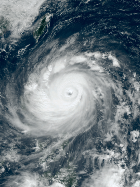
English: Typhoon Haima approaching the Philippines at peak intensity on October 19, 2016. |
| Petsa | |
| Ginkuhaan | RealEarth™ |
| Awtor | AHI image captured by the Japan Meteorology Agency’s Himawari-8 satellite |
| Camera location | | View this and other nearby images on: OpenStreetMap |
|---|
Palilisensya:
This image was produced by the SSEC/CIMSS, University of Wisconsin–Madison. All the images published on their website can be freely used, as long as the source is acknowledged. (disclaimer (archive))
|
 |

Kaagi han paypay
Pidlita an adlaw/oras para makit-an an fayl nga naggawas hito nga oras.
| Pitsa/Oras | Thumbnail | Mga dimensyon | Gumaramit | Komento | |
|---|---|---|---|---|---|
| waray pa kasasapawi | 01:16, 17 Disyembre 2022 | | 3,000 × 4,000 (15.7 nga MB) | TheWxResearcher | 500m resolution |
| 11:16, 19 Oktubre 2016 |  | 1,536 × 2,048 (5.14 nga MB) | Meow | User created page with UploadWizard |
Mga Sumpay
An mga nasunod nga mga pakli nasumpay hini nga paypay:
Global file usage
An masunod nga iba nga mga wiki in nagamit hini nga file:
- Paggamit ha de.wikipedia.org
- Paggamit ha en.wikipedia.org
- Paggamit ha fi.wikipedia.org
- Paggamit ha ja.wikipedia.org
- Paggamit ha ko.wikipedia.org
- Paggamit ha pt.wikipedia.org
- Paggamit ha th.wikipedia.org
- Paggamit ha tl.wikipedia.org
- Paggamit ha uk.wikipedia.org
- Paggamit ha www.wikidata.org
- Paggamit ha zh.wikipedia.org