Paypay:Atlantic Archipelago.jpg
Kadako hin nga pahiuna nga pagawas: 490 × 599 nga mga pixel. Iba nga mga resolusyon: 196 × 240 nga mga pixel | 393 × 480 nga mga pixel | 628 × 768 nga mga pixel | 838 × 1,024 nga mga pixel | 1,676 × 2,048 nga mga pixel | 3,600 × 4,400 nga mga pixel.
Orihinal nga paypay (3,600 × 4,400 nga pixel, kadako han fayl: 1.45 nga MB, MIME nga tipo: image/jpeg)
Dalikyat nga pulong
| Tigtulidong |
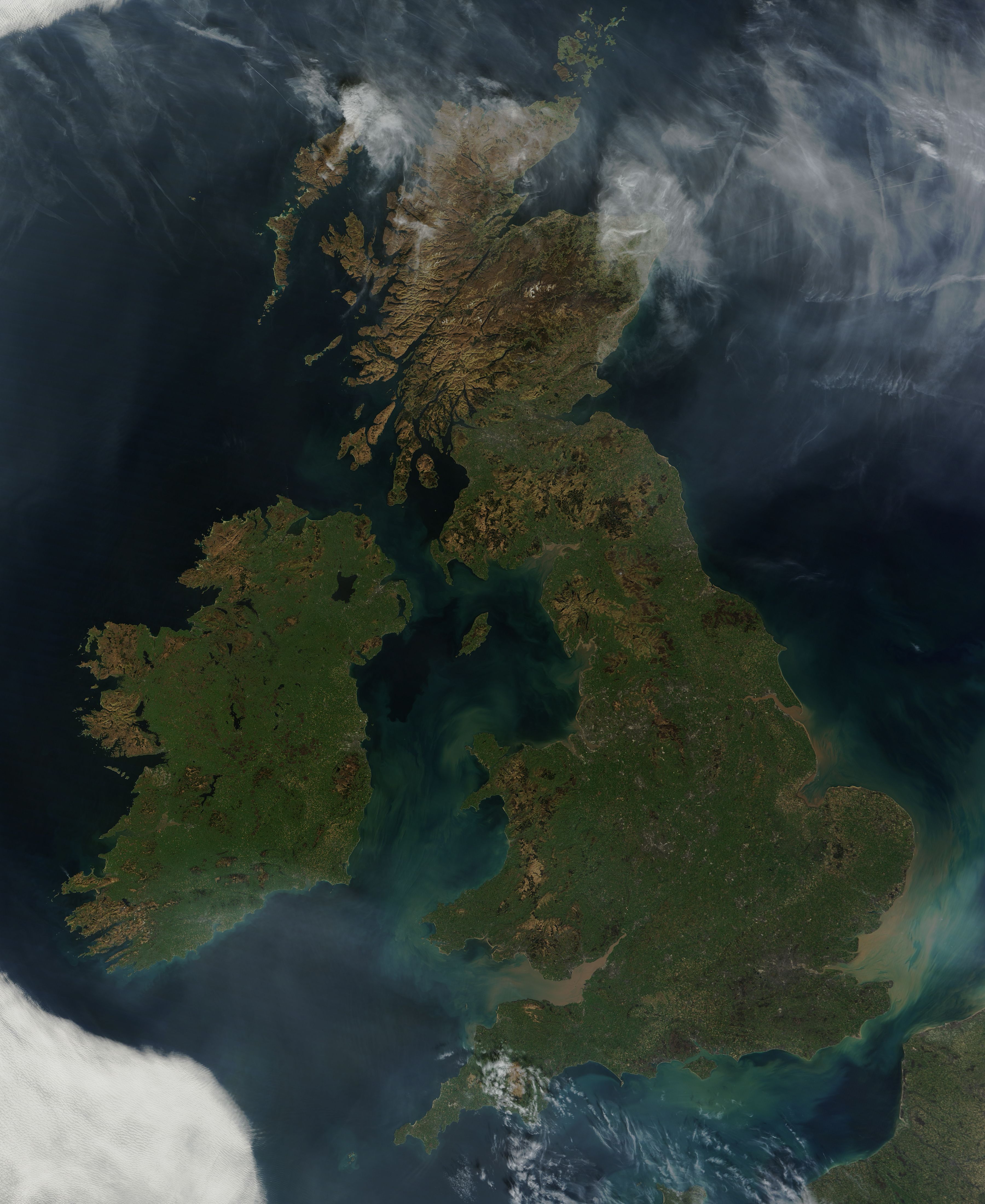
English: This nearly cloud-free view of Great Britain and Ireland was acquired by the Moderate Resolution Imaging Spectroradiometer (MODIS) aboard NASA’s Terra satellite on March 26, 2012. Just a few days into spring, most of the land appears green, although not quite as brilliant as the summertime hues that give Ireland the nickname “the Emerald Island”. |
| Petsa | |
| Ginkuhaan | http://modis.gsfc.nasa.gov/gallery/images/image03282012_250m.jpg |
| Awtor | MODIS Land Rapid Response Team, NASA GSFC |
Palilisensya:
| This file is in the public domain in the United States because it was solely created by NASA. NASA copyright policy states that "NASA material is not protected by copyright unless noted". (See Template:PD-USGov, NASA copyright policy page or JPL Image Use Policy.) | ||
 |
Warnings:
|
Kaagi han paypay
Pidlita an adlaw/oras para makit-an an fayl nga naggawas hito nga oras.
| Pitsa/Oras | Thumbnail | Mga dimensyon | Gumaramit | Komento | |
|---|---|---|---|---|---|
| waray pa kasasapawi | 14:17, 31 Mayo 2012 | | 3,600 × 4,400 (1.45 nga MB) | EverydayMuffin |
Mga Sumpay
An mga nasunod nga mga pakli nasumpay hini nga paypay: